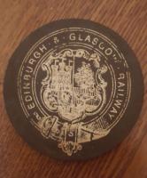
Edinburgh and Glasgow Railway
Introduction
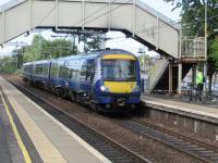
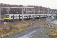
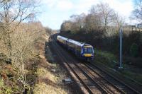
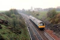
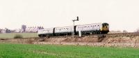
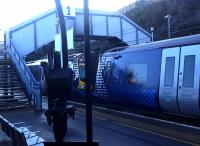
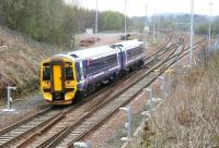
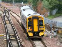
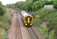
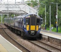
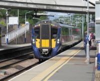
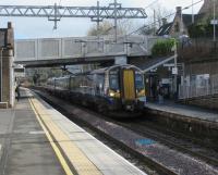
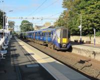
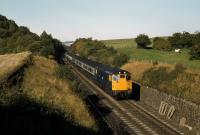
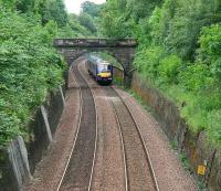
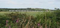
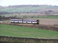
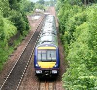
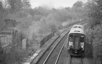
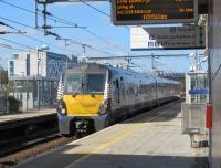
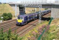
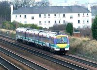
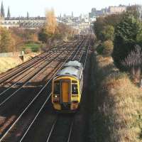
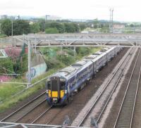
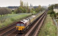
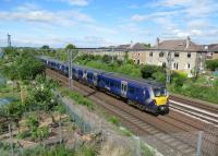
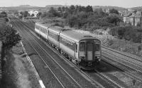
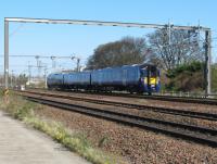
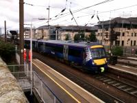
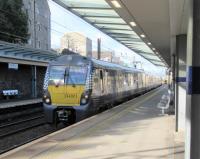
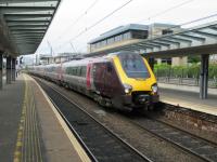
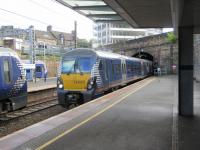
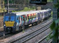
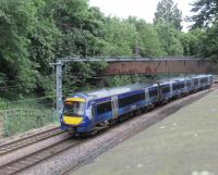
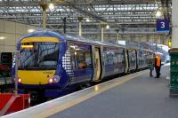
This main line railway is open. The line runs from Edinburgh Waverley to Glasgow Queen Street High Level and carries both express services between those locations and local trains.
Why built
The line was built as an intercity route between Edinburgh and Glasgow to carry passengers and goods.
When first opened the fastest trains, carrying mail, took an hour and a half. Those stopping at the ten stations, and two termini, took two hours.
Service
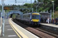
ScotRail runs a regular passenger service runs between Edinburgh Waverley and Glasgow Queen Street High Level.


Dates
| / /1838 | Edinburgh and Glasgow Railway Act receives Royal assent. |
| / /1840 | Nethercroy Colliery In operation above Auchinstarry on Croy Hill, later operated by the Carron Iron Works and they built a railway round the east side of the Croy hill to the Edinburgh and Glasgow Railway. |
| / /1840 | Dunmore Quarry, Polmaise Quarry, Plean Quarry, Bannockburn Quarry Opened after the Scottish Central Railway and Edinburgh and Glasgow Railway opened. |
| / /1841 | Edinburgh and Glasgow Railway Cowlairs Works opens at the north end of the Cowlairs Incline at a site with space to expand. At this time the works site included the locomotive shed (for locomotive operations at the top of the incline). The shed was on the west side of the line and incline engine on the east side. |
| 18/02/1842 | Edinburgh and Glasgow Railway Glasgow Queen Street High Level station opened (originally called Glasgow or Dundas Street). (Date also given as the 21st.) |
| 21/02/1842 | Edinburgh and Glasgow Railway Service starts between Glasgow Queen Street (then simply 'Glasgow') and Haymarket ('Edinburgh'). |
| / /1844 | Edinburgh and Glasgow Railway Banking engines Hercules (loco no 21) and Samson (no 22) tried on the Cowlairs Incline between Glasgow Queen Street High Level and Cowlairs. Rope haulage was used to assist locomotives pulling trains up this incline. The rope was dropped at the top of the incline. Brake vans were used going down into Glasgow Queen Street High Level. |
| 26/12/1844 | Monkland and Kirkintilloch Railway New Kirkintilloch station opened to exchange with Edinburgh and Glasgow Railway station of same name by the Bothlin Viaduct. |
| 26/12/1844 | Monkland and Kirkintilloch Railway Edinburgh and Glasgow Railway's Horse-drawn service between Kirkintilloch Basin station and new Kirkintilloch station commences. |
| / /1845 | Caledonian Railway Approval for a curve at Castlecary from the Caledonian Railway to the Edinburgh and Glasgow Railway. This curve was not built. |
| 01/03/1845 | Edinburgh and Glasgow Railway Passenger service from Glasgow Queen Street to Coatbridge [NB] and Airdrie (Commonhead?) begins around this date. This used the Edinburgh and Glasgow Railway, Garngaber Curve (Monkland and Kirkintilloch Railway), Monkland and Kirkintilloch Railway and Ballochney Railway. The Monkland line was upgraded for this service and began to use steam hauled passenger trains. This new service ran in competition with that from Glasgow Townhead over the Garnkirk and Glasgow Railway to Coatbridge [CR] with a road coach connection to Airdrie. |
| 29/03/1845 | Edinburgh and Glasgow Railway
Monkland and Kirkintilloch Railway
Ballochney Railway
Slamannan Railway At the instigation of the Edinburgh and Glasgow Railway the Monkland and Kirkintilloch Railway, Ballochney Railway and Slamannan Railway pool their receipts. The Wishaw and Coltness Railway did not get involved. |
| /10/1845 | Edinburgh and Glasgow Railway
Wishaw and Coltness Railway The Edinburgh and Glasgow Railway agrees to buy the Wishaw and Coltness Railway. |
| 31/12/1845 | Edinburgh and Glasgow Railway
Monkland and Kirkintilloch Railway
Ballochney Railway
Slamannan Railway The Edinburgh and Glasgow Railway begins to work the Monkland and Kirkintilloch Railway, Ballochney Railway and Slamannan Railway. |
| / /1846 | Stirlingshire Midland Junction RailwayEdinburgh and Glasgow Railway Stirlingshire Midland Junction Railway absorbed by Edinburgh and Glasgow Railway. |
| / /1846 | Edinburgh and Glasgow Railway Edinburgh General station (Edinburgh Waverley) opened further east from Haymarket, the former terminus. |
| / /1846 | Edinburgh and Glasgow Railway
Monkland and Kirkintilloch Railway
Ballochney Railway
Slamannan Railway Bill prepared to merge into the Edinburgh and Glasgow Railway the Monkland and Kirkintilloch Railway, Ballochney Railway andSlamannan Railway. The Bill is rejected. |
| / /1846 | Edinburgh and Glasgow Railway
Monkland and Kirkintilloch Railway
Ballochney Railway
Slamannan Railway On failure of merger Bill the E&G ceases to work the older railways. |
| /01/1846 | Edinburgh and Glasgow Railway
Monkland and Kirkintilloch Railway
Wishaw and Coltness Railway Service from Morningside [1st] to Glasgow Townhead is diverted over the Monkland and Kirkintilloch Railway to reach Glasgow Queen Street. |
| 01/08/1846 | Edinburgh and Glasgow Railway Line extended from Haymarket to meet the North British Railway at North Bridge station. |
| /12/1846 | Edinburgh and Glasgow Railway Wishaw and Coltness Railway The Edinburgh and Glasgow Railway decided not to buy the Wishaw and Coltness Railway, which immediately enters discussions with the Caledonian Railway. |
| / /1847 | Edinburgh Station and Branches (Caledonian Railway) Slateford to Haymarket (Edinburgh and Glasgow Railway) Act passed. |
| / /1847 | Wester Dalry Branch and Dalry Road Lines (Caledonian Railway) Wester Dalry Branch linking the Caledonian Railway to the Edinburgh and Glasgow Railway authorised. The permission is allowed to expire (but is later revived). |
| 04/03/1847 | Edinburgh and Glasgow Railway Cowlairs Incline engine brought back into use, having been fitted with larger cylinders. |
| 01/12/1847 | Edinburgh and Glasgow Railway Glasgow Queen Street to Airdrie service ceases. New service from Glasgow Townhead (Glasgow, Garnkirk and Coatbridge Railway) to Airdrie replaces it. |
| / /1848 | Edinburgh and Glasgow Railway Villas start being built by Lenzie station. |
| / /1848 | Edinburgh and Glasgow Railway Give up using banking engines on the Cowlairs Incline. |
| / /1849 | Wilsontown, Morningside and Coltness Railway Edinburgh and Glasgow Railway Wilsontown, Morningside and Coltness Railway absorbed by Edinburgh and Glasgow Railway. (Confirmed by Act of 1852.) |
| / /1850 | Edinburgh and Glasgow Railway Some villas built by Bishopbriggs station. |
| / /1852 | Wilsontown, Morningside and Coltness Railway Edinburgh and Glasgow Railway Act authorises merger. The Act gives other companies running powers over the main line and Shotts and Bathgate branches. |
| 12/09/1853 | Scottish Central Railway
Edinburgh and Glasgow Railway
Stirling and Dunfermline Railway Operating agreement for the use of Stirling station made by Scottish Central Railway, Edinburgh and Glasgow Railway and Stirling and Dunfermline Railway. |
| 13/10/1853 | Edinburgh Station and Branches (Caledonian Railway) From Slateford Junction [1st] to a bay platform by the Edinburgh and Glasgow Railway's Haymarket station opened. Trains could run from the bay to Carstairs or Falkirk. The line is opened with a running of the Royal Train to Haymarket. The connection at Haymarket was taken out later. |
| 01/04/1858 | Edinburgh and Glasgow Railway Cowlairs station opened, possibly as an exchange in anticipation of the opening of the Glasgow, Dumbarton and Helensburgh Railway the following month. |
| 28/05/1858 | Glasgow, Dumbarton and Helensburgh Railway Opened as single track from Cowlairs Junction to Bowling and Dalreoch Junction to Helensburgh. Due to a disagreement over station access charges between the company and the Edinburgh and Glasgow Railway the first trains ran to Buchanan Street using the Sighthill Branch (Edinburgh and Glasgow Railway) and a connection at St Rollox (Sighthill West Junction) with the Buchanan Street Extension (Caledonian Railway) line. The disagreement was resolved a month later. (Alternative date 31st.) Stations opened at (eastern portion) Maryhill, Dalmuir [1st] and Kilpatrick, and (western portion) Cardross and Helensburgh. |
| / /1860 | Grangemouth Railway (Forth and Clyde Canal Company) Line opened to minerals. Worked by the Edinburgh and Glasgow Railway. (At the time the Carmuirs Curve did not exist and approach from the west was from Larbert.) |
| / /1860 | William Baird & Co
Forth and Clyde Canal
Bairds of Gartshore's Railway Open mines at Twechar, Twechar Swing Bridge laid across the Forth and Clyde Canal for the private line which ran from Kilsyth to Gartshore Loops on the Edinburgh and Glasgow Railway. |
| / /1860 | Gartshore Colliery Pits 9 and 11 Sunk by William Baird & Co to the south of the Edinburgh and Glasgow Railway. |
| / /1860 | Caledonian Railway
Edinburgh and Glasgow Railway
Scottish Central Railway A Bill is presented to merge the Caledonian Railway, Edinburgh and Glasgow Railway and Scottish Central Railway. It is rejected. |
| / /1861 | Cleland to Morningside Line (Caledonian Railway) An extension of the Cleland branch to Morningside [CR] is promoted. The branch will serve numerous mines and the Coltness Iron Works, avoiding the Morningside Incline of the existing route to Morningside [1st]. It also provides possible access to Edinburgh over the Edinburgh and Glasgow Railway owned Wilsontown, Morningside and Coltness Railway. The Morningside [CR] extension of the Cleland branch predates the Cleland and Midcalder Line (Caledonian Railway) which was required after the Wilsontown route was merged into the North British Railway in 1865. |
| 14/08/1862 | Caledonian and Dumbartonshire Junction Railway Caledonian and Dumbartonshire Junction Railway absorbed by Edinburgh and Glasgow Railway. |
| 14/08/1862 | Glasgow, Dumbarton and Helensburgh Railway
Edinburgh and Glasgow Railway The Helensburgh line was absorbed by Edinburgh and Glasgow Railway. |
| / /1864 | Alva RailwayEdinburgh and Glasgow Railway Alva Railway absorbed by Edinburgh and Glasgow Railway. |
| / /1864 | City of Glasgow Union Railway Act receives Royal assent. The line was to join the Glasgow and South Western Railway (part owner of the Glasgow and Paisley Joint Railway) and Edinburgh and Glasgow Railway serving a central Glasgow station and crossing the River Clyde in the city. |
| / /1864 | Caledonian Railway
Edinburgh and Glasgow Railway
Scottish Central Railway Proposed Act for the merger of the Caledonian Railway, Edinburgh and Glasgow Railway and Scottish Central Railway is rejected. |
| / /1864 | General Terminus and Glasgow Harbour Railway Caledonian Railway and Edinburgh and Glasgow Railway agreement. |
| / /1864 | Dugald Drummond Working for Edinburgh and Glasgow Railway. |
| / /1865 | General Terminus and Glasgow Harbour Railway
Caledonian Railway General Terminus and Glasgow Harbour Railway absorbed by Caledonian Railway. Running powers are granted to the City of Glasgow Union Railway, Edinburgh and Glasgow Railway, Glasgow and South Western Railway and Monkland Railways. |
| 31/07/1865 | Monkland Railways
Edinburgh and Glasgow Railway Monkland Railways absorbed by Edinburgh and Glasgow Railway. In addition to the railways the larger company inherited 27 engines. The following day the larger company was absorbed by the North British Railway. |
| 01/08/1865 | Edinburgh and Glasgow RailwayNorth British Railway Edinburgh and Glasgow Railway absorbed by North British Railway. (The Scottish Central Railway and Caledonian Railway are granted running powers over the former Edinburgh and Glasgow Railway main line.) |
| / /1867 | Edinburgh and Glasgow Railway Cowlairs Works becomes the principal works of the North British Railway. |
| / /1868 | Edinburgh and Glasgow Railway Edinburgh Waverley station re-building starts, new station designed by James Bell. |
| / /1870 | Edinburgh and Glasgow Railway Running water becomes available at Lenzie and villa building increases. |
| / /1870 | Stobcross Railway Act passed. To be worked by the Edinburgh and Glasgow Railway with running powers for the Caledonian Railway. The two companies to have separate goods stations. A 30 chain diversion of the Forth and Clyde Canal was required. The line curved round the west of Glasgow after opposition for a more direct route, particularly of James Fleming of Kelvinside Estate. |
| / /1872 | Wester Dalry Branch and Dalry Road Lines (Caledonian Railway) Wester Dalry Branch linking the Caledonian Railway to the Edinburgh and Glasgow Railway authorised (with restrictions on its use). |
| / /1874 | Edinburgh and Glasgow Railway 1868 Edinburgh Waverley station re-building ends. |
| / /1874 | Caledonian Railway Edinburgh and Glasgow Railway Stirlingshire Midland Junction Railway Wester Dalry Branch and Dalry Road Lines (Caledonian Railway) Restrictions lifted. Caledonian Railway granted running power over the Edinburgh and Glasgow Railway. For westbound passenger traffic for the north, the Caledonian Railway must pause at Damhead Junction to pick up any North British Railway coaches. For goods and minerals the company may run from north of Larbert Junction and from Grangemouth Junction over the proposed Wester Dalry branch via Damhead Junction (later Haymarket West Junction) for Edinburgh, Leith and Granton traffic. |
| 30/06/1874 | Dalry Road Lines (Caledonian Railway) Dalry Middle Junction to Haymarket West Junction (Edinburgh and Glasgow Railway) authorised. |
| / /1875 | Gartshore Colliery Opened by William Baird & Co beside the Edinburgh and Glasgow Railway. |
| 03/07/1876 | Dalry Road Lines (Caledonian Railway) Dalry Middle Junction to Haymarket West Junction (Edinburgh and Glasgow Railway) opened. The Caledonian Railway had running powers to Larbert from here. |
| / /1879 | Edinburgh and Glasgow Railway Glasgow Queen Street High Level station re-built. |
| 01/02/1887 | Glasgow City and District Railway Glasgow and Coatbridge Branch (North British Railway) City of Glasgow Union Railway Edinburgh and Glasgow Railway Glasgow, Dumbarton and Helensburgh RailwayStobcross Railway Circular service introduced by the North British Railway. |
| / /1888 | Edinburgh and Glasgow Railway Improvement to Glasgow Queen Street High Level station complete. The tunnel mouth at the foot of the Cowlairs Tunnel was opened out in preparation for the opening of a second (eastern) bore, and although the portal was built the tunnel was not. |
| / /1890 | Edinburgh and Glasgow Railway Edinburgh Waverley extended following opening of the Forth Rail Bridge. |
| / /1896 | Redding Colliery James Nimmo and Company sink new Redding Colliery No 23 shaft, on the north bank of the Union Canal and by the Edinburgh and Glasgow Railway. |
| /10/1901 | Edinburgh and Glasgow Railway New Cadder Yard, a hump shunted marshalling yard, opened by the North British Railway. It was part of a much larger reorganisation of the NBR's goods facilities in Glasgow including rebuilding High Street Goods and Sighthill Goods, and the opening of Shettleston Yard, a further marshalling yard. |
| 12/01/1903 | Glasgow City and District Railway Glasgow and Coatbridge Branch (North British Railway) City of Glasgow Union Railway Edinburgh and Glasgow Railway Glasgow, Dumbarton and Helensburgh RailwayStobcross Railway Circular service withdrawn. |
| / /1904 | John G Stein Opens new brickworks at Castlecary to use higher alumina content, than Bonnybridge, found there. Built by the Caledonian Railway and the Edinburgh and Glasgow Railway. |
| /09/1904 | Edinburgh and Glasgow Railway Eastfield Shed opened north of Cowlairs West Junction. The shed replaced the running shed at the Cowlairs Works |
| 26/08/1909 | Edinburgh and Glasgow Railway End of cable haulage on the Cowlairs Incline. |
| 28/06/1919 | Edinburgh and Glasgow Railway Eastfield Shed damaged by fire, 19 locomotives were damaged. |
| / /1920 | Gartshore Colliery Pit 3 Starts to work coal instead of ironstone, Gartshore Colliery Pit 12 also driven alongside, to the north of the Edinburgh and Glasgow Railway. |
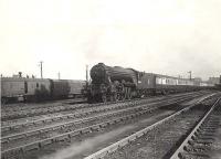
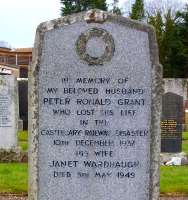
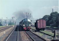
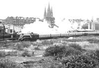
| 10/12/1937 | Edinburgh and Glasgow Railway 35 are killed in a train crash at Castlecary when an Edinburgh to Glasgow express struck the rear of a Dundee to Glasgow. This was the worst crash in the London and North Eastern Railway's history. |
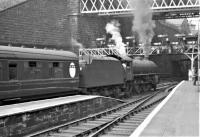
| 03/03/1954 | Edinburgh and Glasgow Railway Accident with banking engine at Glasgow Queen Street High Level station demolishes destination board. |
| 08/01/1956 | Glasgow City and District Railway
Coatbridge Branch (North British Railway)
Monkland and Kirkintilloch Railway
New Monkland Line (Monkland Railways)
Boghead to Cowdenhead Branch (Monkland Railways)
Torbanehill and Bathgate Branch (Monkland Railways)
Edinburgh and Bathgate Railway
Edinburgh and Glasgow Railway Last regular Glasgow Queen Street Low Level to Edinburgh Waverley via Shettleston, Coatbridge Sunnyside and Bathgate Upper service runs. |
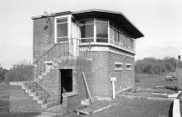
| /11/1956 | Edinburgh and Glasgow Railway Cowlairs Power Box opened. |
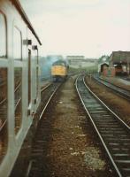
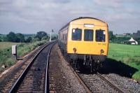
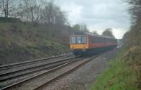
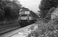
| / /1957 | Edinburgh and Glasgow Railway DMUs used for Edinburgh and Glasgow intercity service |
| 07/01/1957 | Edinburgh and Glasgow Railway Class 126 6 car DMUs introduced on line. |
| 03/02/1958 | Corstorphine Branch (North British Railway) Edinburgh and Glasgow Railway North British Railway North Berwick Branch (North British Railway) Class 100 DMUs introduced on the Corstorphine [2nd] to North Berwick service. |
| 09/09/1960 | Edinburgh and Glasgow Railway A signalling error leads to a collision at Castlecary. |
| 06/01/1964 | Edinburgh and Glasgow Railway Glasgow Queen Street High Level Goods closed. |
| 07/09/1964 | Edinburgh Station and Branches (Caledonian Railway) Duff street connection opened (Duff Street Junction, at Haymarket on the Edinburgh and Glasgow Railway opened). This connection allowed Edinburgh Princes Street to be closed. |
| 07/09/1964 | Campsie Branch (Edinburgh and Glasgow Railway) Kirkintilloch [2nd] to Lenzie Junction closed to passengers. |
| 07/09/1964 | Edinburgh and Glasgow Railway Cowlairs station closed. |
| / /1965 | Edinburgh and Glasgow Railway Glasgow Queen Street High Level closed to steam. |
| / /1966 | Edinburgh and Glasgow Railway The Haymarket Coal Concentration scheme allows many rail served local coal yards in Edinburgh to close. |
| /04/1966 | Edinburgh and Glasgow Railway Cowlairs Goods closed. |
| 04/04/1966 | Campsie Branch (Edinburgh and Glasgow Railway) Lennoxtown [1st] to Kirkintilloch [2nd] to Lenzie Junction (excluded) closed to freight. |
| / /1968 | Edinburgh and Glasgow Railway Cowlairs Works closed. Alternative date: 1966. |
| 29/09/1968 | Edinburgh and Glasgow Railway Collision at Castlecary. |
| / /1971 | Edinburgh and Glasgow Railway DMUs withdrawn from Edinburgh and Glasgow intercity service |
| /03/1971 | Edinburgh and Glasgow Railway Trials begins of trains on the line using a pair of Class 27s. 12 Class 27s were set aside (10 to be used daily) and 36 Mk 2 carriages. |
| 03/05/1971 | Edinburgh and Glasgow Railway 2 x Class 27 trains begin running. |
| / /1973 | Edinburgh and Glasgow Railway Glasgow Queen Street High Level and Glasgow Queen Street Low Level modernised. |
| /06/1977 | Edinburgh and Glasgow Railway Lenzie station buildings demolished. |
| / /1978 | Edinburgh and Glasgow Railway New building opened at Lenzie station. |
| /08/1979 | Edinburgh and Glasgow Railway Tests with push-pull Class 47/7s and Mk 3 carriages and a Mk 2 Driving Brake Standard Open begin. |
| /01/1983 | Edinburgh and Glasgow Railway West Highland Terrier Dog symbol adopted for the depot, with the logo being applied to locomotives (particularly appropriate for the Class 37s on the West Highland Railway). |
| 10/07/1984 | Edinburgh and Glasgow Railway 13 were killed and 61 injured, 17 seriously, when train hit a cow on the line near Polmont. The lightweight driving trailer of the push-pull lifted off the track pushed by the locomotive in the rear. |
| / /1989 | Edinburgh and Glasgow Railway Bridge which carried the Port Dundas Branch (Edinburgh and Glasgow Railway) over Springburn Road to Port Dundas Basin dismantled. |
| / /1989 | Edinburgh and Glasgow Railway Class 158 DMUs introduced to replace Class 47/7s. |
| /10/1992 | Edinburgh and Glasgow Railway Eastfield MPD closed. |
| /05/1997 | Edinburgh and Glasgow Railway Railtrack completes a drainage scheme at Croy at a cost of £460K. |
| /05/1997 | Edinburgh and Glasgow Railway Railtrack plans to spend £670,000 on new pumps and drains and removing silt from the Niddry Burn to prevent flooding of the Winchburgh Tunnel. |
| 27/04/1998 | Edinburgh and Glasgow Railway Derailment at Eastfield MPD. |
| / /1999 | Edinburgh and Glasgow Railway Class 170 'Turbostars' replace Class 158 DMUs. Service increased from half hourly to every 15 minutes. |
| /11/1999 | Edinburgh and Glasgow Railway New station building built at Croy and car park enlarged. |
| 24/07/2001 | Edinburgh and Glasgow Railway 6 people taken to hospital when train from Glasgow hits buffers at Waverley. |
| 26/10/2001 | Edinburgh and Glasgow Railway Winchburgh Tunnel pump destroyed by arson. |
| /09/2002 | Edinburgh and Glasgow Railway Railtrack announces re-wiring of Edinburgh Waverley signal box, despite impending remodelling of Edinburgh Waverley station. |
| 17/01/2004 | North British Railway
Edinburgh and Glasgow Railway During a two day (17-18) blockade Edinburgh Waverley's signalled and control equipment is re-fitted. |
| /03/2004 | Edinburgh Airport Rail Link Proposed scheme would have a station under Edinburgh Airport served by a link off the Forth Bridge Connecting Lines (North British Railway) and the Edinburgh and Glasgow Railway and the Forth Bridge lines. The layout would be southern approaches (both approached from the east) from South Gyle and Gogar combining and passing under Edinburgh Airport before dividing with a western link to Humbie Signal Box and northern link to Dalmeny South Junction. This layout would allow trains from Edinburgh Waverley and Glasgow Queen Street High Level to serve the station and the line to the north from Edinburgh to Fife, Aberdeen and Inverness over the Forth Bridge. The estimated cost was £500M. |
| /03/2004 | Edinburgh and Glasgow Railway Grant of £14M from Scottish Executive to open Eastfield TMD on site of Eastfield MPD. The new depot to open for cleaning, fuelling and overnight stabling. |
| /03/2004 | Edinburgh and Glasgow Railway Automatic ticket barriers installed at Glasgow Queen Street High Level. |
| 17/09/2004 | Edinburgh and Glasgow Railway A cow from a road vehicle escapes onto the railway line damaging fencing near Linlithgow and leading to train cancellations. |
| /12/2004 | Edinburgh and Glasgow Railway Polmont station car park enlarged by 150 spaces. |
| 13/12/2004 | Edinburgh and Glasgow Railway Eastfield TMD opened on the site of the closed and demolished Eastfield MPD. (Haymarket TMD was at capacity.) |
| 10/10/2005 | Edinburgh and Glasgow Railway A proposal to open Bonnybridge station is rejected by councillors despite a 5000 signature petition. The council had received a £450,000 grant from the Scottish Executive to investigate public transport improvements in the M80 corridor. |
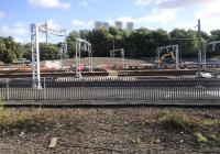
| / /2006 | Edinburgh and Glasgow Railway Glasgow Queen Street High Level: additional platforms intended during a £50m expansion between 2006 and 2012. To finance the work offices and flats are to be built on the car park to the east of the site. [This proposal did not go ahead in this form.] |
| /07/2006 | Edinburgh and Glasgow Railway Completion of extension of Haymarket TMD to allow all Class 170s to be maintained at the site. The cost of £6.72M was largely met by the Scottish Executive. |
| /10/2006 | Edinburgh and Glasgow Railway A £6M multi storey car park is planned by SPT at Croy. |
| /09/2007 | Edinburgh and Glasgow Railway Proposal to make Croy a transport hub with a 900 space car park. |
| /01/2011 | Edinburgh and Glasgow Railway Tenders requested for the reconstruction of Glasgow Queen Street High Level. Redevelopment is to include a link to Buchanan Galleries and a 1500 space car park. |
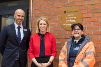
| 23/02/2011 | Edinburgh and Glasgow Railway Scottish Transport Minister Keith Brown opens new 700 space car park, adding to the existing 215, at Croy station. |
| /10/2011 | Edinburgh and Glasgow Railway Glasgow Queen Street High Level to receive new frontage and access to Buchanan Galleries. |
| / /2018 | Millerhill EMU Depot (Network Rail) New EMU depot opened in connection with the electrification of the Edinburgh and Glasgow Railway. |
| /07/2018 | Edinburgh and Glasgow Railway Consort House and the Millenium Hotel extension demolished to allow enlargement of Glasgow Queen Street High Level. |
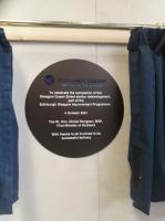
| 04/10/2021 | Edinburgh and Glasgow Railway Official date of completion of the rebuilding of Glasgow Queen Street High Level. |
Route described
The line runs west from Edinburgh to Linlithgow, Falkirk, Lenzie and Glasgow. The route was chosen to be as level as possible and skirts round the north of the high ground south of Falkirk and the Monklands.
Locations along the line
These locations are along the line.
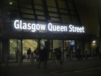
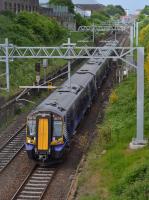
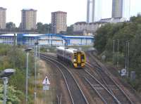
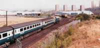
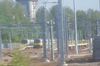
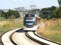
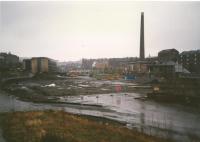
This is a high level terminus with seven platforms under a large glazed barrel roof trainshed to the north of George Square [Glasgow]. It is a terminus for lines to the north, west and east. The railway was electrified in 2016.
...
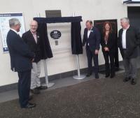
John Yellowlees 11/07/2023
David Bosher 05/09/2022
...
John Yellowlees 04/10/2021
Robin McGregor 26/07/1963
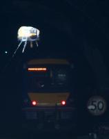
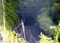
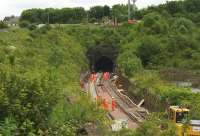
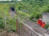
Cowlairs Tunnel (also known as Queen Street High Level Tunnel) runs north from Glasgow Queen Street High Level half way up the Cowlairs Incline to Pinkston. It is a double track tunnel 999 yds long.
...
G H Robin collection by courtesy of the Mitchell Library, Glasgow 20/04/1954
Martin MacGuire 02/06/2016
Colin McDonald 30/01/2016
Colin McDonald 30/01/2016
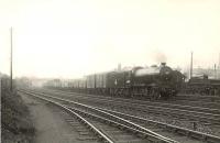
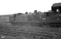
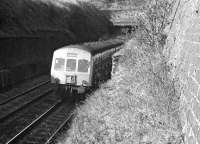
The Cowlairs Incline is a double track mile and a quarter long uphill gradient running north from Glasgow Queen Street High Level to the former station at Cowlairs. The southern half of the route is within the Cowlairs Tunnel.
...
Colin Kirkwood 11/04/1966
G H Robin collection by courtesy of the Mitchell Library, Glasgow 04/07/1955
Colin McDonald 30/08/2017
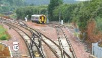
This junction was formed in 1992 with the opening of the south to east curve of the Cowlairs Chord (British Railways). The chord provides direct access to Cumbernauld for trains from Glasgow Queen Street High Level, formerly commencing from Springburn with a connecting Milngavie-Queen Street Low Level-Springburn shuttle. The original Edinburgh and Glasgow Railway is ...
More detailsSee also
Port Dundas Branch (Edinburgh and Glasgow Railway)
Cowlairs Chord (British Railways)
Colin McDonald 22/02/2016
...
More detailsThis was a station located at the top of the Cowlairs Incline. The station had an island platform. Nearby was the steam engine which hauled the cable bringing trains up the incline from Glasgow Queen Street High Level. A footbridge from the south end of the platform connected to the Cowlairs Works. The platform was originally very narrow and was widened around 1908 (after removal of ...
More details
G H Robin collection by courtesy of the Mitchell Library, Glasgow //1956
Ewan Crawford //1987
G H Robin collection by courtesy of the Mitchell Library, Glasgow 26/04/1952
Brian Forbes /04/1987
These carriage sidings were on the east side of the Edinburgh and Glasgow Railway south of Cowlairs West Junction. The Turkey Yard was immediately to the east and, beyond that, the Sighthill Branch (Edinburgh and Glasgow Railway) and the City of Glasgow Union Railway.
...
See also
Sighthill Branch (Edinburgh and Glasgow Railway)
Ewan Crawford //1989
Thomas McPake (Network Rail) /10/2006
Ewan Crawford //1987
Ewan Crawford 28/10/2006
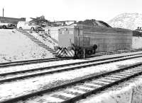
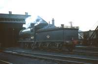
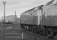
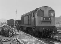
This was the railway works and locomotive shed of the Edinburgh and Glasgow Railway, located on the west side of the railway at the north end of the Cowlairs Incline. Cowlairs station was on the east side of the works, connected to it via a footbridge.
...
Robin McGregor 23/06/1964
John Robin 20/09/1964
John Robin 20/09/1964
This is a four way junction. The 1842 Edinburgh and Glasgow Railway is met by the 1855 Sighthill Branch (Edinburgh and Glasgow Railway) and the 1858 Glasgow, Dumbarton and Helensburgh Railway. The City of Glasgow Union Railway's north end reached here in 1875. In addition the Cowlairs Works was to the south, on the west side.
...
See also
Glasgow, Dumbarton and Helensburgh Railway
City of Glasgow Union Railway
Sighthill Branch (Edinburgh and Glasgow Railway)
Robin McGregor 21/08/1965
G H Robin collection by courtesy of the Mitchell Library, Glasgow 06/09/1955
G H Robin collection by courtesy of the Mitchell Library, Glasgow 06/09/1955
G H Robin collection by courtesy of the Mitchell Library, Glasgow 26/06/1956
An island platform on the west side of the Edinburgh and Glasgow Railway and within the triangle of lines formed by Cowlairs West Junction (to the west), Cowlairs West Junction (to the south) and Cowlairs East Junction (to the north). The platform was served by two loops on the west side of the main line directly west of Eastfield Shed.
...
Eastfield Shed did not date from the opening of the Edinburgh and Glasgow Railway. It replaced Cowlairs Shed, which closed, located north of the Cowlairs Works.
...
Crinan Dunbar //1983
Colin McDonald 05/10/2017
John Yellowlees 16/05/2018
Mark Poustie 12/06/2015
This junction is located at the north of a triangular junction. A curve was put in during 1878 between the 1842 Edinburgh and Glasgow Railway and 1858 Glasgow, Dumbarton and Helensburgh Railway. Its opening allowed goods and mineral trains to run from the north bank of the River Clyde towards Stirling, Falkirk and Edinburgh without requiring a reversal.
...
See also
Cowlairs North Junction to Cowlairs East Junction (North British Railway)
G H Robin collection by courtesy of the Mitchell Library, Glasgow 26/04/1952
G H Robin collection by courtesy of the Mitchell Library, Glasgow 26/04/1952
John McIntyre 16/09/1972
G H Robin collection by courtesy of the Mitchell Library, Glasgow 26/04/1952
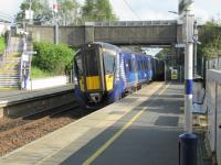
This is a two platform station on the Edinburgh and Glasgow main line and is served by local trains. The main building is on the Glasgow bound platform. The station crosses over Crowhill Drive on a bridge. It is located at Bishopbriggs Cross.
...
Gordon Steel 19/01/2022
David Panton 17/06/1997
David Panton 11/12/2019
David Panton 25/08/2018
This signal box was at the west (Glasgow) end of Cadder Yard. The box was on the south side of the main running lines, the westbound (down) yard departure/headshunt lines being to the south of the box.
...
See also
Cadder Marshalling Yard and Colliery Branches (North British Railway)
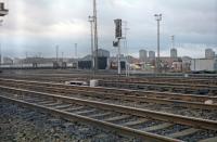
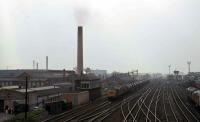
This was a large marshalling yard on the Edinburgh and Glasgow Railway built by the North British Railway. It was hump shunted. The northern part of the yard was looped and the southern part was originally a set of dead end sidings shunted from the west but later looped.
...
See also
Cadder Marshalling Yard and Colliery Branches (North British Railway)
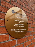
Network Rail 12/05/2022
John McIntyre 23/11/2018
Network Rail 12/05/2022
Network Rail 12/05/2022
This is a two platform station. There is a car park on both sides of the station and the main station building is on the Glasgow, westbound, platform.
...
See also
Campsie Branch (Edinburgh and Glasgow Railway)
John McIntyre 02/09/2018
Alastair McLellan 21/09/2018
Alastair McLellan 21/09/2018
David Panton 08/09/2018
This junction was east of Lenzie station and was the western end of a west to south curve which connected the Edinburgh and Glasgow Railway to the Monkland and Kirkintilloch Railway. The curved line - known as the Bull Curve and requiring a banker going downhill (!) for heavy trains - was single track and connected with the double track mainlined and Garngaber Yard on the south ...
More detailsSee also
Garngaber Curve (Monkland and Kirkintilloch Railway)
Ewan Crawford //
...
More details
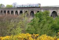
This is a double track five arch masonry viaduct which carries the Edinburgh and Glasgow Railway over the Bothlin Burn and which also crossed the Monkland and Kirkintilloch Railway. The embankment to the east also crossed a feeder for the Forth and Clyde Canal. The viaduct is around 300 ft long.
...
Ewan Crawford 07/04/1987
Ewan Crawford 07/04/1987

Ewan Crawford 07/04/1987
...
More details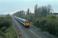
Ewan Crawford //1990
Colin McDonald 22/02/2016
This junction opened in 1895 with a North British Railway built connection from Waterside (on the Edinburgh and Glasgow Railway) south to Bridgend Junction (on the Monkland and Kirkintilloch Railway. It allowed westbound trains on E&G to reach the blast furnaces around Coatbridge without having to run round and reverse at Garngaber High Junction.
...
See also
Waterside Junction to Bridgend Junction (North British Railway)
Mark Dufton /06/1988
Ewan Crawford //1988
Brian Forbes //1988
Ewan Crawford //1988
...
More detailsThis set of sidings were for Gartshore Coal Pits Nos 9 and 11. These were approached from the west and located on the south side of the line. The signal box was on the north side of the line just west of the point of connection of the sidings.
...
...
More detailsThere are loops on either side of the Edinburgh and Glasgow Railway at Gartshore, historically the interchange point with the Bairds of Gartshore's Railway which ran north serving many coal pits. The Gartshore Exchange Sidings were just to the north.
...
See also
Bairds of Gartshore^s Railway
Ewan Crawford //1990
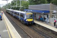
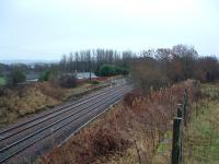
This is a two platform station originally serving a large area but with low population.
...
David Bosher 25/07/2017
...
John Yellowlees 16/07/2022
...
Network Rail /10/2022
This was a two platform station with the main station building on the westbound platform. There were no goods facilities at first, but a small yard was added to the south of the line, west of the station and reached from the west.
...
...
More detailsThis signal box opened east of Dullator station to serve Dullator Colliery (on the north side of the line) and Dullator Sand Quarry (south side). The colliery originally opened in 1913 but failed by 1914 before being resunk in 1934.
...
This mine was located east of Dullator on the north side of the Edinburgh and Glasgow Railway.
...
This was a two platform station at the west end of the Castlecary Viaduct. To the north of the station was the Castlecary Fireclay and Lime Works which was rail served from the east (and had a tramway to the Forth and Clyde Canal).
...
Brian Forbes /08/1988
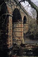
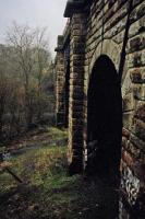
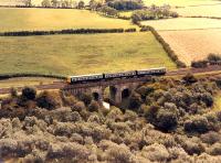
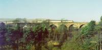
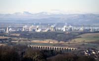
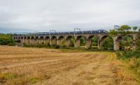
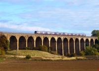
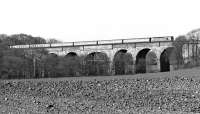
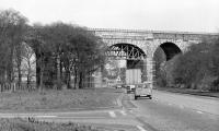
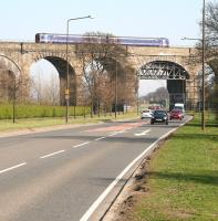
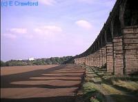
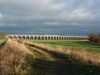
This viaduct enjoys an impressive setting and will be better known to road users than rail users as it crosses the M80. The viaduct is double track, 582 ft long overall, 95 ft high and has eight arches.
...
Colin McDonald 20/10/2015
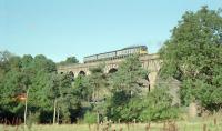
Colin McDonald 13/02/2016
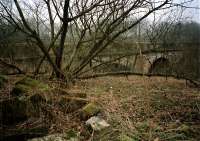
This Edinburgh and Glasgow Railway curve never opened but the earthworks still partly remain.
...
See also
Caledonian Railway
Bill Roberton 27/10/2017
At this junction trains from Glasgow to Edinburgh divide from those from Glasgow to Stirling and Perth. It is the junction between the former Edinburgh and Glasgow Railway of 1842 and the Scottish Central Railway of 1848. Both lines are double track.
...
See also
Scottish Central Railway
Douglas McPherson 22/06/2020
...
Bill Roberton //1990
Network Rail /12/2023
John Furnevel 02/01/2013
This was a relatively short lived station on the Edinburgh and Glasgow Railway which was an exchange point between that line and the Scottish Central Railway also serving the local, somewhat underpopulated, area. It must have been useful for railway employees however.
...
Ewan Crawford 12/01/2018
This was a two platform station almost surrounded by brick works. The station was partly built on a bridge over a road, the station buildings being to the east of this and platforms extending over to the west. There was a goods yard to the south of the line, west of the station and a goods line bypassed the station to the south.
...
...
More detailsThis was the west end of a loop which left the Edinburgh and Glasgow Railway to serve works at Rough Castle and Port Downie on the Forth and Clyde Canal before rejoining the line at Falkirk High goods.
...
See also
Rough Castle Branch (North British Railway)
Array
More details
Ewan Crawford 12/06/1989
Bill Roberton 11/03/2014
Bill Roberton 01/03/1986
Lime Road Goods Station, a yard near Roughcastle, was east of Roughcastle Junction. It was a siding with a loop on the north side of the line, accessed from east. There was a signal box opposite to the south. The west end was later connected to create a loop off the eastbound line.
...
Ewan Crawford //2000
...
More details...
More detailsThis is a two platform station in the south of Falkirk. There is a car park to the north, the former goods yard, and a new station building on the eastbound platform, replacing two typical North British Railway buildings which faced each other on each platform.
...
See also
Callendar Colliery Railway
Rough Castle Branch (North British Railway)
Bill Roberton 16/02/1992
...
John Yellowlees 18/02/1992
David Panton 07/07/2018
This is a double track tunnel of 845 yds length. The tunnel is just to the east of Falkirk High station. The line passes under the west end of the Callendar House grounds here.
...
This box controlled access to the Shieldhill and Redding Collieries Railway, a private mineral line.
...
See also
Shieldhill and Redding Collieries Railway
This shed was west of Polmont station and Polmont Junction to the south side of the Edinburgh and Glasgow Railway. The shed was approached from both east and west. The site was bounded to the south by the Union Canal.
...
A Snapper (Courtesy Bruce McCartney) 15/08/1959
K A Gray 27/07/1959
A Snapper (Courtesy Bruce McCartney) 15/08/1959
Robin Barbour Collection (Courtesy Bruce McCartney) 27/07/1959
This panel box is on the north side of Polmont Junction. It replaced Polmont Junction and Bo'ness Junction [1st] signal boxes in 1979.
...
See also
Stirlingshire Midland Junction Railway
This junction is between the Edinburgh and Glasgow Railway of 1842 and the Stirlingshire Midland Junction Railway of 1850.
...
See also
Stirlingshire Midland Junction Railway
John Furnevel 07/08/2007
John Furnevel 23/04/2010
John Furnevel 07/08/2007
John Furnevel 07/08/2007
This is a two platform station on the Edinburgh and Glasgow main line. There is a station building on the eastbound platform.
...
David Panton 16/07/2020
David Panton 16/07/2020
Network Rail /09/2020
David Panton 14/03/2019
This signal box was east of Polmont station on the north side of the line. East of the station a long siding on the south side of the line was converted into a loop and a bay platform single track was added to the east end of the eastbound platform.
...
This junction gave the Edinburgh and Glasgow Railway access to the Bo'ness branch (Slamannan and Borrowstounness Railway). Approach was from the west. Both lines were doubled with the branch dropping to single track after Bo'ness Low Junction. This layout dated from 1893 when a signal box ('Manuel High Level') opened here. The original 1851 connection was not direct but by ...
More detailsThis is the junction for the Bo'ness and Kinneil Railway [Preserved] located at the west end of the former Manuel High Level station. Access to the line is by reversal from the eastbound line of the Edinburgh and Glasgow Railway to a headshunt on the north side of the line.
...
See also
Slamannan and Borrowstounness Railway
Bill Roberton 25/05/1974
This was largely an interchange station between the Edinburgh and Glasgow Railway and the routes to Bo'ness and Slamannan. There were three high level platforms, two on the main line and a bay at the west end of the westbound platform for trains to Blackston Junction and beyond. Manuel Low Level was below at the east end of the high level station. When opened there was very ...
More detailsSee also
Slamannan Junction Railway
Bill Roberton 06/08/2013
Bill Roberton 20/10/2013
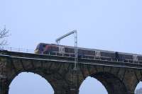
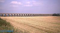
This is a double track 23 arch masonry viaduct, 442 yards long and 70 ft high, west of Linlithgow station.
...
John Clark 05/03/2005
Ewan Crawford 08/10/2017
John Furnevel 30/05/2005
This was a goods yard in the west of Linlithgow, west of Linlithgow station itself. The sidings were on a loop on the north side of the line. To the west is the Avon Viaduct.
...
David Panton 27/11/2019
This is a two platform station. An original station building stands on the eastbound platform, a remarkable survivor. The building is two storeys, one seen from the platform. At its east end is a covered area. The west end of the eastbound platform is slightly cantilevered out over St Michael's Wynd.
...
David Bosher 16/03/2019
David Panton 23/09/2020
This was a two platform station just to the north of the rail served Philpstoun Oil Works with which it was associated. The works had its own railway network spreading out to various oil shale mines.
...
John Clark /09/1979
John Furnevel 07/07/2007
This junction opened in 1890 between the 1842 Edinburgh and Glasgow Railway and the approach to the then new Forth Bridge. It is the western end of a line which runs to Dalmeny. This was a double track junction.
...
See also
Forth Bridge Connecting Lines (North British Railway)
Bill Roberton //1990
Jim Peebles 27/04/2014
Bill Jamieson /04/1972
This was a two platform station located partly in the cutting just to the north of Winchburgh Tunnel.
...
David Laurie 08/09/2023
Jim Peebles 14/09/2014
Jim Peebles 14/09/2014
Jim Peebles 01/05/2014
This is a double track tunnel with the former Winchburgh station at the north end and the former Broxburn West Signal Box for the Niddry Castle Oilworks to the south. At both ends it approaches in long cuttings.
...
Colin McDonald 19/05/2015
Bill Jamieson /04/1972
Colin McDonald 02/07/2015
Bill Roberton 14/06/2015
This box controlled access to the Niddry Oilworks sidings from the Edinburgh and Glasgow Railway. The sidings were on the east side of the line, approached from the south.
...
This was a short lived station. It opened not long after the Edinburgh and Glasgow Railway but was too distant from Broxburn itself and closed shortly afterwards.
...
This junction on the Edinburgh and Glasgow Railway was for the Broxburn Oil Works branch, the Broxburn Railway. The branch also served the Albyn Oil Works. The branch was approached from the north.
...
See also
Broxburn Railway
Ewan Crawford 26/12/2003
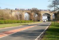
This is a seven arch viaduct which crosses the A89. The viaduct is 139 yds long overall and 55 ft high. To the east is the much longer Almond Valley Viaduct.
...
John Furnevel 02/04/2009
Bill Jamieson /04/1972
Bill Jamieson /04/1972
John Furnevel 02/04/2009
This is a double track masonry 36 arch viaduct. The viaduct is 681 yds long overall and 60 ft high. The east end of the viaduct crosses the River Almond, the rest crossing the low lying land to the west. Alternative names for this viaduct are Almond Viaduct, Ratho Viaduct and Newbridge Viaduct.
...
Gordon Steel 10/02/2022
Ewan Crawford 28/12/2003
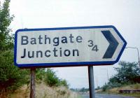
Bathgate Junction was created with the opening of the Edinburgh and Bathgate Railway line west to Bathgate [1st] in 1849. It met the Edinburgh and Glasgow Railway of 1842.
...
See also
Edinburgh and Bathgate Railway
John Furnevel 21/11/2009
John Furnevel 29/06/2008
This former station gave rise to the curiosity that is Ratho Station, a small village on the edge of Edinburgh with no station. (Akin to Balfron Station or even Stromeferry (no ferry)). Ratho Station, the village, developed to the north of the station.
...
Bill Roberton 24/08/1985
Bill Roberton //1999
...
Bill Roberton //1985
John Furnevel 11/06/2006
This junction was east of Ratho station (on the 1842 Edinburgh and Glasgow Railway) and Ratho (Low Level) (on the 1866 South Queensferry Branch (North British Railway)), formed with the branch opened.
...
See also
South Queensferry Branch (North British Railway)
Frank Spaven Collection (Courtesy David Spaven) 30/04/1961
The passenger and goods stations at Gogar were at different locations. Gogar is a rural area right on the western edge of Edinburgh.
...
David Panton 08/05/2021
David Panton 30/06/2021
David Panton 22/07/2019
David Panton 21/10/2019
This is a two platform modern glass and steel station built in Edinburgh Park, a business park to the south of the Gyle Centre and to the west of Edinburgh.
...
David Panton 05/08/2020
David Panton 14/04/2021
David Panton 08/09/2021
David Panton 21/04/2021
Array
More detailsThis was a four platform station on raised embankments to the east side of Saughton Road in western Edinburgh.
...
See also
Forth Bridge Connecting Lines (North British Railway)
John Furnevel 25/07/2014
John Furnevel 26/10/2002
John Furnevel 25/07/2014
John Furnevel 02/11/2006
This junction is west of Edinburgh. This is where the Edinburgh and Glasgow Railway of 1842 is met by the Forth Bridge Connecting Lines (North British Railway) of 1890. The location is just east of the former Saughton station. Both lines are double track and from the east of the junction to Edinburgh the line is quadrupled.
...
See also
Forth Bridge Connecting Lines (North British Railway)
David Panton 29/07/2021
Bill Roberton 27/04/2002
David Panton 05/06/2021
Bill Roberton //1990
This signal box was around a quarter of a mile to the east of the original connection between the 1890 Forth Bridge Connecting Lines (North British Railway) and the 1842 Edinburgh and Glasgow Railway at Corstorphine Junction. The signal box was on the south side of the line. The box opened in 1894, a year in advance of the quadrupling of the line between Corstorphine Junction and ...
More detailsThis junction opened in 1876 when the Wester Dalry Branch and Dalry Road Lines (Caledonian Railway) opened, allowing Caledonian Railway trains from Edinburgh Princes Street to join the Edinburgh and Glasgow Railway westbound and then, via the Stirlingshire Midland Junction Railway, join the Scottish Central Railway at Larbert Junction and run north to Stirling, ...
More detailsSee also
Corstorphine Branch (North British Railway)
Edinburgh, Suburban and Southside Junction Railway
Wester Dalry Branch and Dalry Road Lines (Caledonian Railway)
David Murray-Smith 14/08/1961
David Panton 16/07/2018
David Panton 13/04/2019
Brian Haslehust //1963
This is a train maintenance depot in the west of Edinburgh, just west of Haymarket station and accessed from the east.
...
Bill Roberton //1983
Roger Geach 24/06/1981.
Bill Roberton //1983
This junction is west of Haymarket station and Haymarket East Junction. The junction opened with the Edinburgh, Suburban and Southside Junction Railway junction in 1884.
...
See also
Edinburgh, Suburban and Southside Junction Railway
John Clark //1971
Charlie Niven 20/06/2016
John Furnevel 01/09/1979
John Furnevel 01/09/1979
This coal yard was immediately east of where the Edinburgh and Glasgow Railway was crossed by the Granton Branch (Caledonian Railway).
...
Bill Roberton 07/04/1986
Bill Roberton //1986
Bill Roberton //1981
This goods yard was built to the north of Haymarket station. Approach was from Haymarket Central Junction and Haymarket Coal Yard was just to the west, also on the north side of the line.
...
David Panton 19/01/1998
David Panton 07/04/2021
David Panton 16/10/2019
David Panton 13/04/2020
This junction is directly west of Haymarket station. It opened in 1964, finally completing the line from Slateford Junction [1st] laid down in 1859. The connection was known as the Duff Street Spur. This joined together the former Edinburgh and Glasgow Railway and the Edinburgh Station and Branches (Caledonian Railway).
...
See also
Edinburgh Station and Branches (Caledonian Railway)
Mark Bartlett 27/02/2023
John Furnevel 25/07/2007
David Panton 07/08/2017
Bill Roberton //1988
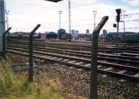
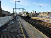
This is a five platform station in the west of Edinburgh where the Edinburgh and Glasgow Railway and Caledonian Railway divide. An 1842 Georgian building, by John Miller, dating from the opening as a terminus now fronts a station which is a train, tram and bus interchange.
...
Network Rail /12/2023
David Panton 02/09/2020
David Panton 16/06/2021
David Panton 28/04/2021
The Edinburgh and Glasgow Railway was extended east from Haymarket through Haymarket Tunnels to what is now Edinburgh Waverley station through Princes Street Gardens and the Mound Tunnels under The Mound in 1846.
...
Bill Roberton 10/06/2023
David Panton 13/08/2021
David Panton 06/08/2021
John Furnevel 21/11/2019
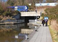
This is the main station in Edinburgh and acts as both a terminus and through station. The larger part of the station is covered by a large glazed roof by Blyth and Cunningham and is an island platform with bays at either end. There is a smaller island platform outwith the main roof on the south side.
...
See also
North British Railway
Borders Railway (Network Rail)

John Yellowlees 23/09/2023
Bill Roberton 21/04/2023
...
Bill Roberton 27/12/2022
Books