Arbroath and Forfar Railway
Introduction
This pioneering line ran from Arbroath (Catherine Street) to Forfar (Playfield). It was a 5 ft 6 in line. With the opening of long distance lines it was re-gauged to standard gauge. The bulk of it was not a main line but the portion from Forfar North Junction to Guthrie Junction became part of the Strathmore main line route to Aberdeen and the short portion north from Arbroath became part of the East Coast main line route to Aberdeen.
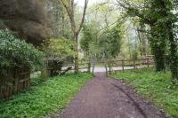
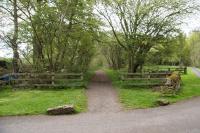
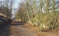
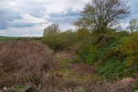
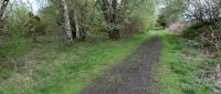
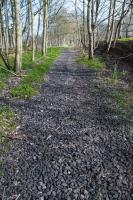
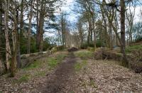
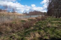
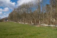
The line is closed (except for a short section between St Vigeans Junction and Arbroath). Today the nearest station is at Arbroath.


Dates
Portions of line and locations
This line is divided into a number of portions.
Arbroath to Forfar
A goods branch of the Arbroath and Forfar Railway extended south as a double track line beyond the terminus at Arbroath (Catherine Street) to Arbroath Harbour. South of Grimsby Loading Bank, a goods yard between South Grimsby and Shore, the line subdivided into sidings to Arbroath Saw Mills (to the west), west and south side of the Arbroath Wet Dock and the north side of the ...
More detailsThis was a goods station on the Arbroath Harbour goods branch, the sidings being approached from the north. The yard was located between South Grimsby and Shore. To the south lines divided to reach Arbroath Saw Mills, Arbroath Harbour and Arbroath Wet Dock. The loading bank was on the west side of the yard.
...
David Murray-Smith 03/04/1961
David Murray-Smith 03/04/1961
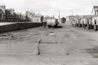
This was the Arbroath terminus of the Arbroath and Forfar Railway. A goods line continued beyond the station, on its east side, to Arbroath Harbour.
...
This junction was directly north of today's Arbroath station. It was the connection between the Arbroath and Forfar Railway of 1838 and the Junction Line (Dundee and Arbroath Railway) of 1847 which linked the A&F to the Dundee and Arbroath Railway.
...
See also
Junction Line (Dundee and Arbroath Railway)
...
Bill Roberton //1987
Duncan Ross 03/06/2021
...
Bill Roberton //1987
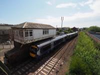
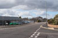
Arbroath signal box remains open today, alongside Wellgate level crossing.
...
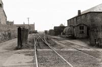
This was a two road shed north of Arbroath and Arbroath Junction. It was on the east side of the line north of the Cairnie Street / Guthrie Port bridge. Access was via a reversing spur which made a trailing connection to the southbound line. There was a turntable on the eastern of the two shed roads.
...
This was a three road shed built to the north of Arbroath station on the line to Forfar. It was similar to Forfar Shed [2nd] in appearance (which still stands) but with three lines.
...
This junction, north of Arbroath station, was where the North British, Arbroath and Montrose Railway (later North British Railway) met the Arbroath and Forfar Railway (later Caledonian Railway).
...
See also
North British, Arbroath and Montrose Railway
Sandy Steele /05/2009
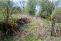
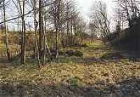
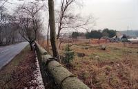
This level crossing was directly east of St Vigeans Church, the Arbroath and Forfar Railway crossing over a minor road. There was no station or goods yard. There was a crossing keeper's cottage and a small frame for signals, later a gatebox. The North British, Arbroath and Montrose Railway was later built just to the east, crossing the same road with a bridge. To the south was [[St ...
More details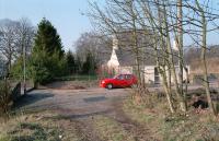
Ewan Crawford //1996
Ewan Crawford 10/05/2023
This siding was north of St Vigeans Junction on the closed line to Forfar. The siding was on the east side of the line and approached from the north. Just to the north was a level crossing. There was a signal box on the east side of the line, just south of the crossing, and a trailing crossover. The siding led to the Letham Mill.
...
Ewan Crawford 10/05/2023
This was a private level crossing for Letham Quarry. The crossing had a hut on the west side of the line (labelled S.B. on Ordnance Survey maps). There was a dwarf lever frame here.
...
Ewan Crawford 10/05/2023
This was a level crossing with the public road to Waulkmill. The crossing had a gatekeeper and hut on the west side of the line (labelled S.B. on Ordnance Survey maps). A dwarf lever frame was installed on the north side of the crossing in 1909.
...
Ewan Crawford 10/05/2023
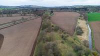
This was the location of a siding to Waukmills Bleachfield (different spelling). Today the location is known as Waulkmills. The siding, a headshunt for the mill, made a trailing connection to the southbound line. A short loop ran from the headshunt to the mill with a single line continuing to a turnplate with a siding at right angles going further into the works. The signal box was on the west ...
More details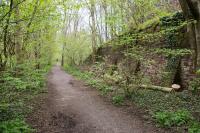
Ewan Crawford 10/05/2023
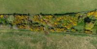
This was a linen mill on the Brothock Water, producing yarn. It was a large works about three miles north of Arbroath on the east side of the Arbroath and Forfar Railway and served by a siding which approached from a reversing spur to the west and ran into the works via a short loop and a turnplate. It was owned by John Hay of Letham Grange House. These works were originally waulk ...
More detailsThis was a station with two staggered platforms. The northbound platform was north of the level crossing on the west side, with the goods yard to the east (served from the north), and the southbound platform to the south of the crossing on the east side. A footbridge, south of the road, crossed the line. This had two sets of stairs at its east end (one from the roadway and another from the ...
More details
Ewan Crawford 10/05/2023
Ewan Crawford 10/05/2023
Ewan Crawford 10/05/2023
This was a two platform station with staggered platforms. The northbound platform was slightly south of the southbound platform, the platforms separated by a level crossing. There was a timber footbridge to the south east of the level crossing. A small station building stood on the southbound platform, the building being replaced at least once. There was a grounded carriage alongside.
...
Ewan Crawford 10/05/2023
Ewan Crawford 10/05/2023
Ewan Crawford 10/05/2023
Ewan Crawford 10/05/2023
This quarry, which predated the railway, was served by a short line which ran west from Leysmill station. The station's goods yard acted as a headshunt for the branch. The line also served a small brick works, the Leysmill Brick and Tile Works.
...
This signal box controlled access to Border Quarry, on the north/east side of the railway. There was a long private siding running from the southbound line, with which it made a trailing connection. This served the north part of the quarry and had a headshunt which served the southern part. There was a public siding on the south/west side of the line, making a trailing connection to the ...
More details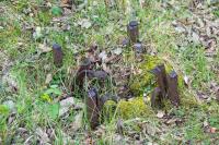
Ewan Crawford 10/05/2023
Ewan Crawford 10/05/2023
Ewan Crawford 10/05/2023
Ewan Crawford 10/05/2023
This quarry was on the north/east side of the Arbroath and Forfar Railway, which served it with a siding making a trailing connection to the southbound line. Border Signal Box controlled the signalling.
...
Ewan Crawford 10/05/2023
This quarry was on the south/west side of the Arbroath and Forfar Railway, which served it with a siding making a trailing connection to the northbound line. Border Signal Box controlled the signalling. There were tramways within the quarry. It was soon eclipsed by the larger Border Quarry on the north side of the line.
...
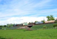
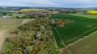
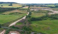
This junction had a very chequered history - opening and re-closing several times. This junction was between the 1848 Aberdeen Railway and the Forfar to Arbroath line (the 1839 Arbroath and Forfar Railway). The junction allowed trains to run from Dundee East and Arbroath to Aberdeen. Both lines meeting at the junction were double track. Catchpoints on the Forfar route protected ...
More detailsSee also
Aberdeen Railway
Ewan Crawford 10/05/2023
Ewan Crawford //1996
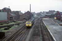
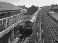
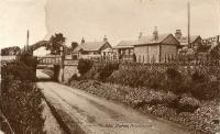
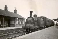
This station was originally on the Arbroath and Forfar Railway built to the 5'6'' gauge. After control passed to the Aberdeen Railway the line was converted to standard gauge and doubled, a part of the line becoming a portion of the West Coast Main Line. This was a two platform station, partly built on an bridge over a road with a goods yard at the south or east end consisting of two sets ...
More details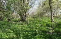
Ewan Crawford 10/05/2023
Douglas Blades 02/09/1967
Ewan Crawford Collection //
Ewan Crawford //1996
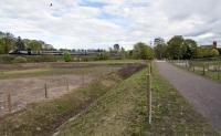
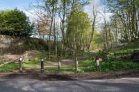
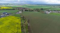
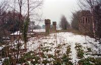
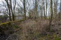
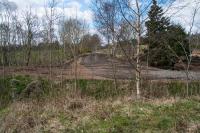
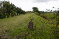
Although the site of Guthrie station, just to the west of the junction, has been largely landscaped (except for some buildings and a loading bank), the junction remains recognisable.
...
See also
Aberdeen Railway
Ewan Crawford 11/04/2023
G H Robin collection by courtesy of the Mitchell Library, Glasgow 06/04/1958
Ewan Crawford //1996
G H Robin collection by courtesy of the Mitchell Library, Glasgow 18/07/1953
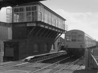
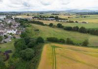
This was a junction station opened on the route of the former 1838 Arbroath and Forfar Railway for the opening of the 1848 Aberdeen Railway. Guthrie Junction was to the east.
...
Ewan Crawford //1996
G H Robin collection by courtesy of the Mitchell Library, Glasgow 02/05/1949
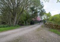
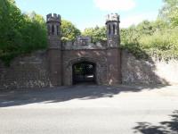
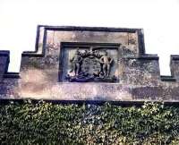
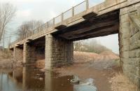
This is a small attractive railway bridge, a single arch over a private driveway, in use from 1838. It is west of the former Guthrie station and south of Guthrie Castle. The line crossed over the main entry to the castle. The bridge is listed 'B'. The bridge is castellated with small octagonal towers and the emblem of the Guthrie family on a tablet. A lodge was also built. (A similar ...
More details
Ewan Crawford 11/04/2023
Ewan Crawford //1996
John Yellowlees 05/06/2021
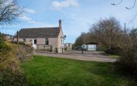
This level crossing was located half a mile east of Auldbar Road station. The double track main line crossed over the road and there was a railway cottage on the north side of the line, directly east of the crossing. This cottage still stands and has a bay window which overlooked the line with a clear view west and east.
...
Ewan Crawford 11/04/2023
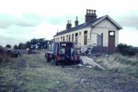
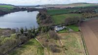
This was a two platform station by Balgavies Loch. The platforms were to the west of a road overbridge and the goods yard was to the east. The low platforms were linked by a footbridge, removed before line closure. A large timber building was on the westbound platform and smaller building on the eastbound.
...
Ewan Crawford 10/04/2023
Ewan Crawford 11/04/2023
Ewan Crawford 10/04/2023
Ewan Crawford 11/04/2023
This was a gatekeeper's cottage located between Auldbar Road (to the east) and Clocksbriggs (to the west) stations. The private level crossing was directly to the west. The cottage still stands.
...
Ewan Crawford 11/04/2023
This was a private level crossing towards the east end of Rescobie Loch, between Auldbar Road (to the east) and Clocksbriggs (to the west) stations. There was a hut directly to the east. The crossing may not have been original and probably provided access to the south side of the loch.
...
Ewan Crawford 10/04/2023
This was a private level crossing towards the west end of Rescobie Loch, between Auldbar Road (to the east) and Clocksbriggs (to the west) stations. The crossing gave access to a boat house on the south side of Rescobie Loch.
...
Ewan Crawford 18/05/2023
This was a private level crossing north of Reswallie House, between Auldbar Road (to the east) and Clocksbriggs (to the west) stations.
...
Ewan Crawford 11/04/2023
This was a two platform station on the Strathmore main line with the main station building on the northbound platform and a level crossing at the west end. There had been a footbridge at the west end of the station.
...
Ewan Crawford 10/04/2023
Ewan Crawford 10/04/2023
Ewan Crawford 11/04/2023
Ewan Crawford 11/04/2023
This oil depot was west of Clocksbriggs station on the north side of the line. A set of sidings on the north side of the line served the depot. These were approached by reversal over the level crossing to the east.
...
This was a public level crossing between Forfar North Junction and Clocksbriggs station. The railway crossed the road on an oblique angle, a gatekeeper's cottage being to the east of the crossing between the two.
...
Ewan Crawford 11/04/2023
Ewan Crawford 10/05/2023
At Forfar North Junction the routes west to Forfar [1st] (Playfield) and Perth diverged and the routes east to Aberdeen and Broughty Ferry diverged. The Arbroath and Forfar Railway (arriving here in 1839), Scottish Midland Junction Railway (1848) and Dundee and Forfar Direct Railway (1870) met here.
...
See also
Dundee and Forfar Direct Railway
Scottish Midland Junction Railway
Ewan Crawford 18/07/2023
Ewan Crawford 18/07/2023
Ewan Crawford 18/07/2023
Ewan Crawford //1996
Ewan Crawford 11/04/2023
This locomotive shed was built for the Arbroath and Forfar Railway. It was a little north east of the Forfar [1st] terminus, also known as Playfield. It was probably not the very first shed in Forfar as an original at the station was removed to allow expansion of the goods yard there. The shed was on the south side of Market Street and north side of the line, which crossed the street just ...
More details
Ewan Crawford 18/07/2023
This was the terminus of the Arbroath and Forfar Railway in Forfar. In 1848 the station was replaced by Forfar [2nd] on the opening of the Scottish Midland Junction Railway and the re-gauging of the Arbroath and Forfar Railway.
...

