Border Union Railway (North British Railway)
Introduction
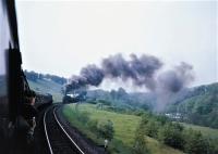
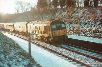
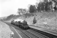
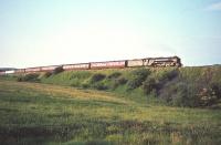
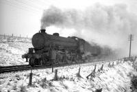
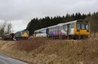
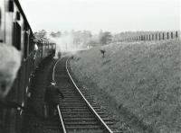
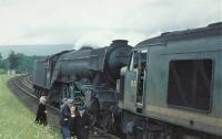
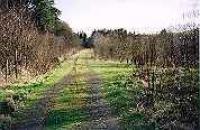
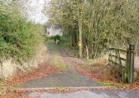
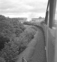
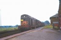
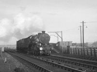
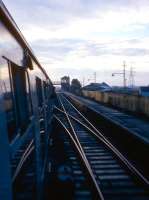
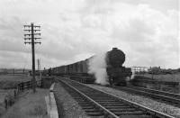
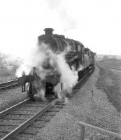
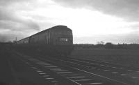
This line is closed. The railway formed an integral part of what became known as the Waverley Route which ran between Edinburgh Waverley and Carlisle. Its closure was one of the first mainline railway closures in Britain. Occasionally possibilities of its re-opening are discussed, sometimes associated with timber extraction at Kielder. In the meantime preservation societies have laid track and started reinstating the line between Whitrope Tunnel and Riccarton Junction. Long distance trains using the line ran between Edinburgh Waverley and Carlisle (Citadel) many continuing south by the Settle and Carlisle Line (Midland Railway) and Midland Railway route to London St. Pancras. The line had a distinctive style of looped goods yard - often loop off one of the lines almost all the sidings would be looped.
 22/05/1963")


 //")

 //1964")

Dates
Locations along the line
These locations are along the line.
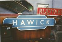
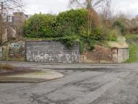
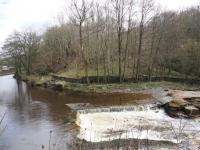
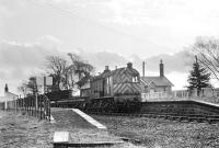
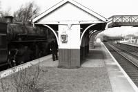
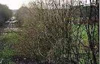
This station is closed. The station was opened to the immediate north of the Teviot Viaduct along which its platforms extended.
...
David Panton 07/09/1996

Colin Kirkwood 04/01/1969
John Yellowlees 30/11/2018
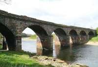
This gently curved six (five?) arch double track viaduct was south of Hawick [2nd] station, the platforms from which extended out over the River Teviot. The platform extensions were in timber, on a metal frame built out from the sides of the viaduct. The viaduct was 42 feet high.
...
Duncan Ross 18/03/2023
John Furnevel 27/12/2017
Bill Roberton //1975
Colin Miller 18/09/2013
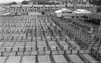
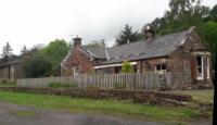
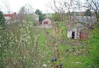
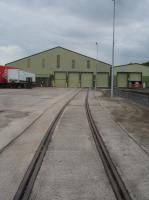
Workshops opened at Loch Park in 1921 to replace the workshops at Riccarton Junction. The works closed in the mid 1960s, before the line closed in 1969.
...
Duncan Ross 18/03/2023
Duncan Ross 18/03/2023
Duncan Ross 18/03/2023
Doug Nicholls /05/1976
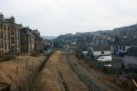
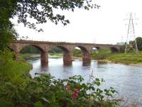
This six arch double track viaduct, also known as Lynnwood Viaduct, was south of Hawick [2nd].
...
Duncan Ross 18/03/2023
Duncan Ross 18/03/2023
Duncan Ross 19/03/2023
Duncan Ross 18/03/2023
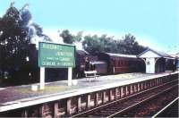
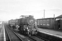
This station was a large terminus with four platforms serving a military training and prisoners of war facility (Stobs Military Camp) near Stobs. There were two island platforms of two faces and a loop for the centre two platform faces. Also known as Stobs Camp Siding.
...
See also
Stobs Military Camp Railway
John Furnevel 06/02/2008
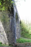
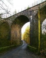
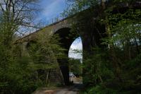
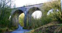
This is a disused double track four arch masonry viaduct just north of the former Stobs station. It is also known as Barns Viaduct or Stobs Viaduct. The overall length is 242 ft.
...
Ewan Crawford 05/05/2014
John Furnevel 06/02/2008
Ewan Crawford 05/05/2014
John Furnevel 06/02/2008
This was a two platform station just to the south of Barns Viaduct. It had a cattle dock on the west side at the north end of the station, approached from the north.
...
Robin McGregor 05/06/1965
Bruce McCartney //
Bruce McCartney 11/04/1967
Robin Barbour Collection (Courtesy Bruce McCartney) /09/1964
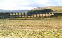
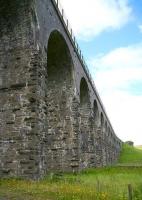
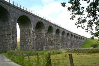
This is an impressive disused double track fifteen arch masonry viaduct to the north of the former Shankend station. The viaduct is 597 ft long and 60 ft high.
...
John Furnevel 06/02/2008
John Furnevel 10/07/2009
...
John Furnevel 10/07/2009
Ewan Crawford 05/05/2014
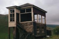
This was a two platform station at the south end of the Shankend Viaduct. It had three looped sidings on its east side, approached from the south end of the station where the signal box was located. The two storey station building, with single storey ticket office at the north end, was on the southbound platform.
...
Colin Kirkwood 17/04/1965
Doug Nicholls /08/1974
Ewan Crawford 05/05/2014
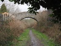
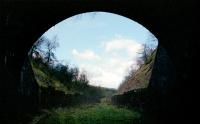
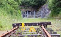
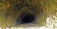
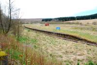
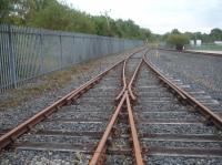
This is a disused twin track tunnel, 1208 yards long. It is the 6th longest railway tunnel in Scotland. It is located between the former Shankend and Riccarton Junction stations on the closed Waverley Route.
...
Ewan Crawford //1998
John Furnevel 10/07/2009
Ewan Crawford 05/05/2014
Charlie Niven /11/1993
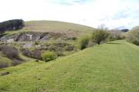
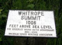
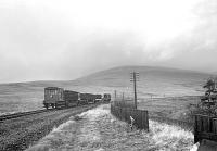
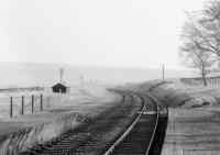
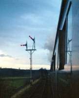
This was a summit of the Border Union Railway (North British Railway) at 970 ft.
...
Bill Roberton 04/06/2016
Ken Strachan 10/07/2015
Robin Barbour Collection (Courtesy Bruce McCartney) //
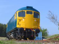
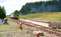
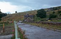
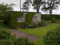
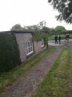
This is a new station built in 2010 and opened on a section of preserved line.
...

Mark Bartlett 26/02/2023
John Furnevel 10/07/2009
John Furnevel 10/07/2009
Mark Bartlett 26/02/2023
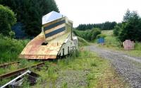
This large culvert over the Whitterhope Burn also crossed a road. An enormous amount of material was required for its construction which resulted in its becoming known as the Golden Bridge. Also known as the Whitterhope Culvert. The location is just south of Whitrope Siding.
...
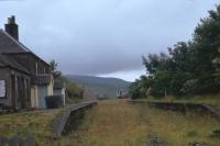
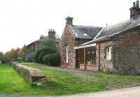
This was an important location in Scottish railway history. This was a large station, junction, locomotive shed, workshops, yard and railway owned village all built at a remote location in the Scottish Borders with no road access. It is a highly evocative location built on the famous former Waverley Route. Here the double track mainline from Edinburgh and Hawick, to the north, split to run ...
More detailsSee also
Border Counties Railway
Ewan Crawford //2000
Ewan Crawford 04/05/2012
Ewan Crawford //1993
...
More details...
More detailsThis was a two platform station on the 'The Steele', the southern slopes of Arnton Fell. The small village here was entirely associated with the station. The platforms were in brick with the main station building on the northbound platform.
...
Bill Roberton 04/06/2016
Bruce McCartney //1969
Ian Holoran 25/05/1969
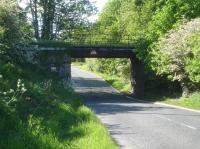
This double track viaduct crossed the Hermitage Water directly upstream of where it joins the Liddel Water, it also crossed the road on the east side of the river.
...
This was a two platform station on the west side of Newcastleton. The main station building, of a single storey, was on the southbound platform.
...
Brian Haslehust 13/06/1964
Doug Nicholls /08/1974
Brian Haslehust 13/06/1964
Brian Haslehust 13/06/1964
This was a two platform with timber platforms, small timber shelters and a level crossing at the north end. The single storey station house and offices were on the east side of the station, stone built. Not far to the north was the official Scotland/England Border of the line (two others existed south of Riddings Junction close to Liddel Strength).
...
John Furnevel 03/11/2007
John Furnevel 03/11/2007
K A Gray 18/04/1965
Weekend only service on a Saturday, only a southbound train. Some timetables still had the halt after 1873 until the 1880s.
...
The dates are assumed. The Railway Clearing House name is Peter's Crook, the name of a farm just to the south west. This quarry, which might be described as Watleyhirst Quarry, was served by a looped siding off the Waverley Route. The loop was on the west side of the line. To the north it connected to the northbound line and to the south to the southbound line. There was a tramway to the quarry, ...
More detailsThis was a two platform station with a two storey station building on the southbound platform, signal box at the north end of the same platform and a goods yard on the east side, approached from the north.
...
Bruce McCartney /08/1967
John Furnevel 03/11/2007
K A Gray 09/07/1961
John Furnevel 03/11/2007
This was the junction between the Waverley Route and the branch to Langholm. It was a three platform station, two main line platforms and the main northbound was an island whose second face, on west side of the station, served the branch.
...
See also
Langholm Branch (North British Railway)
David Murray-Smith 16/03/1961
Bruce McCartney 03/12/1966
Ewan Crawford //
Joyce Barker Collection (Courtesy Langholm Archive Group) //1962
This was a two platform station with a minor level crossing at the north end and a goods yard on the west side, approached from the south. The main station building was on the northbound platform with a small shelter on the southbound.
...
John Yellowlees 01/06/2019
John Furnevel 03/11/2007
Bill Roberton 01/06/2019
...
Bruce McCartney /08/1967
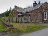
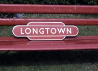
This was a two platform station. The two storey main station building was on the southbound platform. To the immediate north of this was a staff bothy and a large water tank. To the south, over a level crossing, was Longtown Branch Junction where the routes to Carlisle and Gretna [NBR] divided. To the north was a goods yard on the east side and locomotive shed on the west side.
...
K A Gray //
D Walker Collection [Courtesy Bruce McCartney] 04/01/1969
K A Gray //1962
This was a two platform station just west of the small village of Westlinton in Cumbria, England. There was a level crossing to the south and a goods yard to the north on the east side of the line.
...
Bill Roberton 01/06/2019
John Furnevel 03/11/2007
Bill Roberton 01/06/2019
John Yellowlees 01/06/2019
This was a two platform station. There was a goods yard to the north, on the east side of the line. The main station building was on the southbound platform.
...
Ewan Crawford //1998
This private halt had two platforms. It was built in 1941 to serve Carlisle RAF Maintenance Unit (14MU), just to the west. The RAF depot was expanded to cover a considerable area. The halt was named for Park House, just to the west.
...
John Clark /07/1969
...
More details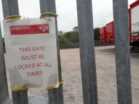
David Pesterfield 14/09/2021
David Pesterfield 04/06/2021
David Pesterfield 14/09/2021
Robin McGregor 06/08/1965
Ewan Crawford //
Robin Barbour Collection (Courtesy Bruce McCartney) //1966
K A Gray 28/12/1968
John Furnevel 18/04/2007
Colin Alexander 03/08/2011
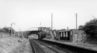
This single ended shed was in the 'V' of the junction between the Border Union Railway and the Silloth branch. It was served from the east, from Canal Junction, splitting off the Border Union just after the junction.
...
...
Colin Kirkwood 28/04/1963
John Robin 24/06/1962
K A Gray //1960
K A Gray 12/04/1963
Books