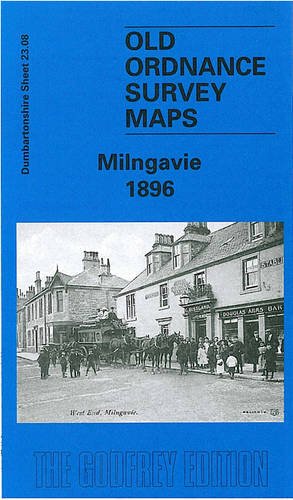
Milngavie
Location type
StationName and dates
Milngavie (1863-)Station code: MLN National Rail ScotRail
Where: East Dunbartonshire, Scotland
Opened on the Glasgow and Milngavie Junction Railway.
Description
This is a two platform station with original sandstone single storey station building fitted with a newer canopy.
The signal box at Milngavie was located to the south of a public park's access bridge near the station on the east side of the track. (It was new in 1900, replacing a box on the north side of the same bridge and on the west side.) Near this point the single track becomes double approaching the terminus. To the west tracks diverged to the Ellangowan Paper Mill. This branch enclosed the turntable, the site of which is now a Kwik Fit garage. To the east of the station was the goods yard, now a large car park, and between the goods yard and the station was the single-road locomotive shed. A fence runs down the east side of the up platform (from the end of a stone wall which was part of the shed) to restrain passengers from falling onto the removed shed track. The station was originally three platforms. The third platform (removed in the 1980s) originally had a rounding loop. Two platforms remain today. The original station building also remains (plus 1899 canopy) with its flagstone floor. A new bypass road was brought through Milngavie from the old tram terminus to the station when the town received its pedestrian precinct. This has altered the fencing to the north of the station a little.
The original turntable was at the end of the branch, the north end of the station. Platforms 2 and 3 were added during the rebuilding which followed doubling of the line in 1900.
The station was built to the east of the site of the Allander Print Works.
Local
The station is at the east end of the original town.
Milngavie is the starting point of the West Highland Way long distance footpath.
Gavin's Mill
Tags
Terminus Station footpathExternal links
Canmore site recordNLS Collection OS map of 1892-1914
NLS Collection OS map of 1944-67
NLS Map
NLS Map
NLS Map
Facilities
Gaelic name: Muileann-GaidhListing: B


| Nearby stations Bennie Railplane Hillfoot Bearsden Bardowie Summerston [1st] Westerton Balmore Strathblane Maryhill [Temporary] Summerston Maryhill Drumchapel Blanefield Gilshochill Kelvindale | Allander Print Works Milngavie Shed Ellangowan Paper Mill Burnbrae Goods Burnbrae Dye Works Allander Sports Centre Burnbrae Junction Tourist/other Dam Tannoch Loch Dougalston Loch Craigmaddie Reservoir Mugdock Reservoir Kilmardinny Loch Kilmardinny House New Kilpatrick Cemetery Antonine Wall |
| Location names in dark blue are on the same original line. | |
Terminus for BallochAround 1900 a service ran from Balloch Central to Milngavie. This ran east through Westerton to Glasgow Queen Street Low Level, then via Springburn to Glasgow Queen Street High Level. It then departed running via Maryhill (without calling) and Westerton to terminate in Milngavie. |
Chronology Dates
| / /1863 | Glasgow and Milngavie Junction Railway
Forth and Clyde Junction Railway Local coach operators start a service between Milngavie and Balfron stations. |
| 28/08/1863 | Glasgow and Milngavie Junction Railway Line opened as a single track. Stations at; Bearsden, Milngavie. The line ran from Milngavie to Milngavie Junction (later renamed Westerton Junction) with trains continuing to Glasgow Queen Street High Level until the Glasgow City and District Railway opened after which trains started to serve Glasgow Queen Street Low Level. |
| / /1899 | Glasgow and Milngavie Junction Railway Milngavie station was re-built and a canopy was added to the original station building. |
| 24/04/1900 | Glasgow and Milngavie Junction Railway The line was doubled from Milngavie Junction to Milngavie. |
| 01/09/1913 | Glasgow and Milngavie Junction RailwayGlasgow, Dumbarton and Helensburgh Railway Westerton station opened at the junction of the Milngavie line with the Singer line. Westerton Garden Suburb was being established in what was previously farmland to the north of the line. |
| 08/07/1930 | Bennie Railplane
Glasgow and Milngavie Junction Railway Test track opened above the Burnbrae Goods branch of the Milngavie line. |
| /10/1956 | Allander Scheme Public enquiry for the National Coal Board's proposed Allander Scheme to mine for coal under Bearsden and Milngavie, no decision reached. |
| /07/1959 | Glasgow and Milngavie Junction Railway Failed Class 303, in use for driver training, replaced temporarily by British Railways Eastern Region Tilbury sets. Driver training was carried out on the Milngavie line, reversing at Westerton. |
| 05/11/1960 | Glasgow North Bank Electrification Service begins with electric services to termini at; Helensburgh Central, Balloch Pier, Singer Workers Platforms station, Milngavie, Bridgeton Central, Springburn, Airdrie. The new trains (Class 303s) built at Pressed Steel Co Ltd, Linwood, became known as the Blue Trains, these were used in all the Glasgow electrification schemes. |
| / /1983 | Glasgow and Milngavie Junction Railway Track of platform 3 at Milngavie lifted. |
| /07/1989 | Yoker Re-signaling Scheme Re-signaling complete. Boxes at Helensburgh Central, Craigendoran, Dumbarton Central, Dalmuir Park, Singer, Milngavie, Westerton, Hyndland, Clydebank Dock, High Street East Junction, Bellgrove, Parkhead, Shettleston, Heatheryknowe Junction, Sunnyside Junction, Airdrie replaced by the new Yoker Signalling Centre. |
| / /1992 | Glasgow and Milngavie Junction Railway Line singled from Milngavie Junction to just west of Bearsden and from just east of Hillfoot station to just south of Milngavie station. |