Anstruther and St Andrews Railway
Introduction
This line is closed. The line ran round the East Coast of Fife between the towns in its title.
 //")
 //")
 //")


Dates
Locations along the line
These locations are along the line.
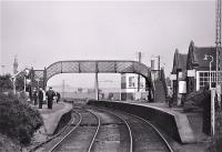
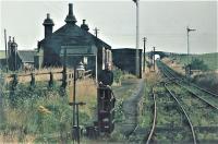
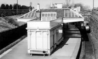
This was the junction between the Leven and East of Fife Railway of 1863 and the Anstruther and St Andrews Railway of 1883, both single track lines. With the extension the original Anstruther [1st] station became a goods yard on a short branch, replaced by Anstruther [2nd] which was to the north and a little further east. The signal box was on the north side of the junction.
...
See also
Leven and East of Fife Railway

Colin Miller 14/06/2015
...
More details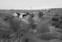
Bill Roberton //1992
Colin Miller 21/09/2011
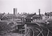
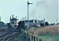
This was a two platform station with the main building on the westbound platform. It replaced Anstruther [1st] just to the south which was left on a short branch when the line was extended and became a goods yard.
...
Brian Haslehust 24/06/1964
Brian Haslehust 04/09/1965
Brian Haslehust 04/09/1965
Brian Haslehust 04/09/1965
...
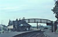
More detailsThis two platform station was the principal station between St Andrews and Anstruther [2nd]. The building was of a larger design to the rest of the line. It was on the western edge of Crail. The building was on on the southbound - town side - platform.
...
Brian Haslehust 04/09/1965
Brian Haslehust 04/09/1965
Frank Spaven Collection (Courtesy David Spaven) //1964
Frank Spaven Collection (Courtesy David Spaven) //1965
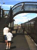
This was a two platform station with a passing loop. It was some way west of Kinsbarns itself - around a mile. The main station building was on the southbound platform, the town side. Platforms were joined by a footbridge.
...
Brian Haslehust 04/09/1965
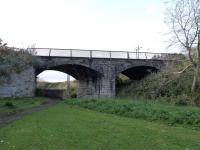
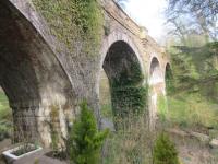
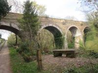
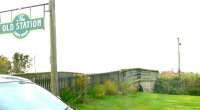
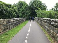
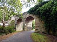
This disused single track five arch viaduct over Kenly Water is immediately east of the former Boarhills station.
...
John Yellowlees 13/04/2021
...
John Yellowlees 13/04/2021
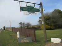
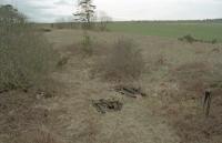
This was a single platform station to the south of Boarhills. The platform was on the north side of the line, the town side. There was a goods yard to the north, accessed from the west. To the east is the single track Boarhills Viaduct.
...
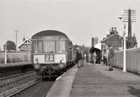
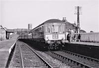
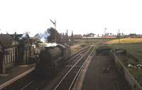
This was a two platform station with a loop on a single track line. The eastbound platform and loop were a later addition of 1898, when the original 1887 signal box was replaced. The main station building was on the original westbound platform, with the signal box to its east.
...
John Yellowlees 13/04/2021
John Yellowlees 13/04/2021
...
John Yellowlees 13/04/2021
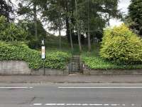
This station is closed. It was south of St Andrews [2nd].
...
Ewan Crawford //1996
...
More details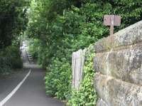
Colin McDonald 15/06/2017
Colin McDonald 15/06/2017
Colin McDonald 15/06/2017
Colin Miller 20/09/2011
This was an island platform station located below street level. In addition to the two faces of the island platform, there was a loading dock at the north end, with a short section of platform alongside the southbound line. Also known as the new station.
...
See also
St Andrews Junction Line (North British Railway)
John Yellowlees 16/06/2017
Ewan Crawford //1996
Colin McDonald 16/06/2017
Books