Bonnyrigg
Location type
StationNames and dates
Bonnyrigg [PR] (1855-1866)Bonnyrigg Road (1866-1868)
Bonnyrigg (1868-1962)
Note: text in square brackets is added for clarity and was not part of the location's name.
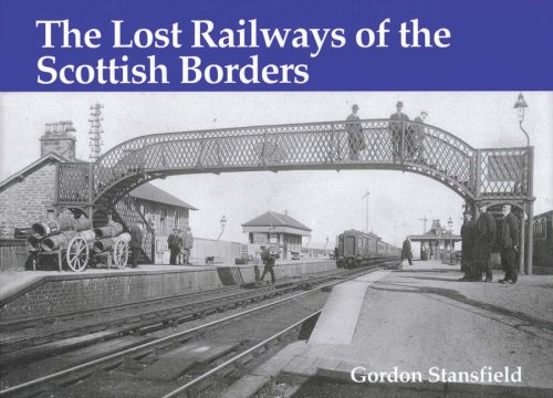
Opened on the Peebles Railway.Description
This was a two platform station in the south of Bonnyrigg, built by the Peebles Railway. Bonnyrigg also served by Bonnyrigg [EVR], to the north.
The passenger station was to the south of a level crossing with Dundas Street, a crossing keeper's house to the west of the line, south of the road. Next to this, on the northbound platform, was the station building. Opposite the crossing keeper's cottage, on the east side of the line, was the signal box looking out over the crossing and goods yard.
To the north of the level crossing was the goods yard, on the east side of the line and accessed by a reversing spur from the southbound platform. The yard had a loading bank and goods shed.
To the south of the station was a single track branch for Polton Colliery No 2, the crossover for which was in the passenger station. The branch ran to exchange sidings, on the east side of the line and accessed from the north, before continuing to the colliery itself.
To the south of this branch was Bonnyrigg Gatehouse, a level crossing, with a signal box (Polton No 2 Signal Box) on the west side of the line, north of the crossing, and a siding on the west side approached from the north.
Continuing south the was another siding for a coal mine on the west side, approached from the north, and further south again and a reversing siding on the west side approached from the north for Dalhousie Colliery. A platelayers hut remains at this location.
The station was in the double track section between Esk Valley Junction and Hawthornden. This was doubled in 1872 when the Penicuik Railway opened due to increased traffic from this line, the collieries and the Esk Valley Railway.
When first opened there was probably no loop, just the later northbound platform.
Bonnyrigg [PR] became Bonnyrigg Road in 1866 to avoid confusion with Bonnyrigg [EVR]. Bonnyrigg [EVR] became Broomieknowe in 1868.
The station closed in 1962, but the line remained open to goods. In 1964 the line was singled and 1965 the box closed, replaced with a ground frame. The railway closed in 1967, latterly used as the route to Penicuik [2nd].
The crossing keeper's cottage was still intact but out of use in the 1990s when the trackbed was made into a footpath and the platforms were tidied up.
The trackbed within the passenger station remains intact and the platform still exist. The station building has gone but the crossing keeper's cottage(or a modern building with similar footprint) remains. Unfortunately the trackbed to the north and the goods yard, have been built over. To the south the trackbed is a footpath.
Tags
Station footpathExternal links
NLS Collection OS map of 1892-1914NLS Collection OS map of 1944-67
NLS Map
NLS Map
NLS Map
NLS Map


| Nearby stations Broomieknowe Lasswade South Esk Dalhousie Eskbank Eskbank and Dalkeith Newtongrange [1st] Newtongrange Polton Glenesk Dalkeith Sheriffhall [2nd] Loanhead Rosewell and Hawthornden Sheriffhall [1st] | Phillip^s Siding Bonnyrigg Catchpoints Eldin Colliery Bonnyrigg Carpet Factory Polton Colliery No 2 Polton Colliery No 1 Lasswade Tunnel Esk Valley Junction Hardengreen Viaduct Dalhousie Catchpoints Lasswade Viaduct St Leonards Mill Dalhousie Colliery Newbattle Viaduct [1st] Tourist/other Polton No 2 Signal Box |
| Location names in dark blue are on the same original line. | |
Chronology Dates
| /12/1866 | Peebles Railway Bonnyrigg [PR] re-named Bonnyrigg Road. |
| 01/08/1868 | Peebles Railway Bonnyrigg Road re-named Bonnyrigg [PR]. |
| 11/09/1962 | Peebles Railway Remains of line closed to passengers; Bonnyrigg station and Rosewell and Hawthornden station closed. (Alternative date 10/9/1962). |