Lochs, and lakes, water
Introduction
By no means and exhaustive list of lochs and lakes, this is a list of bodies of water near railways.


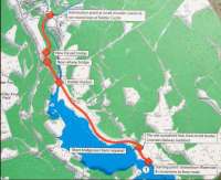
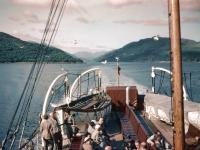
 22/09/1959")


Locations along the line
These locations are along the line.
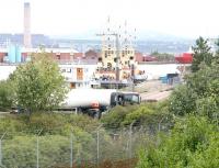
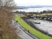
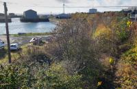
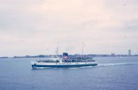
Aberdeen's harbour lies on its east side. The harbour was built around the entry of the River Dee into the sea.
...
...
More details...
More details...
More details...
More details...
More details...
More details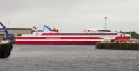
Colin Miller 08/05/2023
Colin Miller 15/08/2022
Colin Miller 06/08/2023
...
More detailsArray
More details...
More details...
More details...
More details...
More details...
More details...
More details...
More details...
More details...
More details...
More details...
More details...
More details...
More details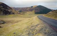
Ewan Crawford //2002
Array
More detailsCarron Dock (originally New Dock) was opened in 1883 by the Caledonian Railway to the south of Grangemouth Old Dock, with which there was a connection, and continued east to join the River Carron. This was a ship dock with a large entry lock, rather than a dock for canal sized vessels. The Caledonian were the new owners of the Grangemouth Railway and its former owner the [[Forth and ...
More detailsSee also
Grangemouth Railway (Forth and Clyde Canal)
Bill Roberton //1987
John Furnevel 23/09/2008
...
More details...
More details...
More details
Mark Poustie 28/01/2017
Mark Poustie 24/01/2010
...
More detailsThis reservoir is a feeder for the Union Canal. It came into North British Railway ownership when the railway took over the canal. Water, for locomotive use, was sold by the NB to the Caledonian Railway, the latter's main line running down its western side.
...
...
More details...
More details...
More detailsThis reservoir, just north of Milngavie, provides drinking water for Glasgow. It is connected to Loch Katrine by a long distance pipeline, duplicating the existing pipeline which supplied the existing Mugdock Reservoir (directly to the west).
...
...
More details...
More details...
More details...
More details...
More details...
More details...
More details...
More details...
More details...
More details
G W Robin 06/07/1959
G W Robin 06/07/1959
G W Robin 04/07/1959
Aitken Scott //
...
More details...
More details...
More details...
More details...
More details...
More details...
More details
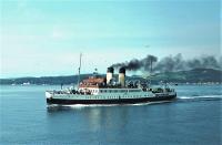
A Snapper (Courtesy Bruce McCartney) 22/09/1959
...
More details...
More details...
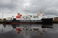
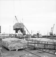
More detailsThis is one of the principal docks in the port of Grangemouth, located towards its eastern end. It is chiefly involved in container traffic. The dock was opened in 1906, built on a site to the south of the course of the River Carron.
...

Ewan Crawford //1997
...
More details...
More details...
More details
Ewan Crawford //2000
Bill Roberton //1987
...
More details...
More detailsArray
More details...
More details...
More details
Mark Bartlett 21/09/2021
Mark Bartlett 23/10/2017
...
More details...
More details
John Furnevel 04/11/2013
John Furnevel 06/11/2007
John Furnevel 06/11/2007
...
More details...
More details...
More details...
More details
Brian Haslehust //1963
Brian Haslehust //1963

...
More details...
More details...
More details...
More details...
More details...
More details...
More details...
More details...
More details...
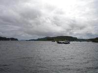
More detailsThis sea loch, around five miles long, runs inland from the coast at Roshven (to the south) and is bounded to the north by Ardnish finishing at Kinlochailort where Lochailort station on the Mallaig Extension (West Highland Railway) is located north of the loch. The River Ailort continues east to Loch Eilt, the railway following the north bank.
...
...
More details...
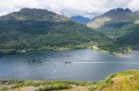
More detailsLoch Awe is in Argyll, Scotland.
...
...
More details...
More details...
More details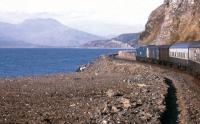
Frank Spaven Collection (Courtesy David Spaven) //1971
...
More details...
More details...
More details...
More details...
More details...
More detailsThis sea loch is just over 7 miles loch and runs from west from The Narrows at Annat (the north end of Loch Linnhe) to Kinlocheil (Ceann Lochiall). The Mallaig Extension (West Highland Railway) runs along the north bank serving Loch Eil Outward Bound and Locheilside.
...
...
More details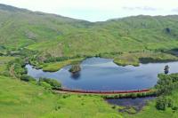
John Gray 30/06/2021
...
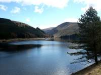
More detailsThis is a 16 mile long ribbon loch which runs south south west from Dalwhinnie to near Loch Rannoch. The loch became a reservoir in 1931 and there are dams at either end. Ben Alder is to the west.
...
...
More details...
More details...
More details...
More details...
More details...
More details...
More details...
More details...
More details...
More details...
More details...
More details...
More details...
More details...
More details...
More details...
More details...
More details...
More detailsArray
More details...
More details
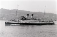
A Snapper (Courtesy Bruce McCartney) 06/09/1955
A Snapper (Courtesy Bruce McCartney) 06/09/1955
...
More details
Brian Haslehust 29/05/1965
A Snapper (Courtesy Bruce McCartney) 14/09/1955
Ewan Crawford 31/05/2022
...
More details...
More details...
More details...
More details...
More detailsThis freshwater loch is between Aviemore (about four miles to the west) and Cairn Gorm Mountain. The loch is noted for its sandy beach.
...
See also
Aviemore and Coylumbridge Timber Railway (War Department)
...
More details...
More details...
More details...
More details...
More details...
More details...
More details...
More details...
More details...
More details...
More details...
More details...
More details...
More details...
More details...
More details...
More detailsThis is an inland loch.
...
...
More details...
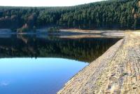
More detailsThis is a six mile long ribbon loch which runs north north east from Craig-uaine-ach Lodge to Fersit. The West Highland Railway portion from Corrour to Tulloch runs along the east side of the loch, dropping in height on its way north. The area is remote and not served by public roads. Loch Treig became a reservoir in 1929, the northern end of the line requiring a deviation onto ...
More details...
More details
...
More details...
More details...
More details...
More details...
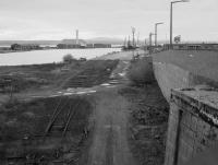
More detailsThis dock was built for the export of coal. It had three coal hoists, one approached by rail from the south (on the west side), two approached from the north (one on the west side one at the north end) and a rail served quayside on the east side.
...
See also
Leven Extension Railway (Wemyss and Buckhaven Railway)
Kirkland Yard and Leven Dock to Methil Line Widening (North British Railway)
...
Bill Roberton 28/10/2022

Bill Roberton 16/06/1984
...
Bill Roberton 16/06/1984
Bill Roberton 16/06/1974
The Methil docks are still in operation. They were principally built for the export of coal. A substantial network of railways and yards served the docks.
...
...
More detailsThis reservoir was opened just north of Milngavie in 1859 by Glasgow Corporation as part of a scheme to supply water to Glasgow from Loch Katrine.
...
...
More detailsFrom the north, going through 360 degrees:
...
David Pesterfield 23/06/2006
David Pesterfield 17/06/2013
...
More details...
More details...
More details...
More details...
More details...
More details...
More details
Colin Kirkwood 24/07/1968
Colin Alexander 17/10/1981
Peter Todd 18/10/2013
...
More details...
More details...
More details...
More details...
More details...
More details...
More details...
More details...
More details...
More details...
More details...
More details...
More details...
More details...
More details...
More details
Brian Haslehust 14/04/1962
Brian Haslehust //1969
...
John Gray /07/1988
...
Colin Miller //1963
...
More details...
More details...
More details...
More details...
More details...
More details...
More details...
More details...
More details...
More details...
More details...
More details
John Furnevel 01/02/2006
John Furnevel 30/11/2005
...
More details...
More details...
More details...
More details...
More details...
More details...
More details...
More details
Alan Cormack 14/01/2018
Alan Cormack 14/01/2018
...
More details...
More details...
More details...
More details...
More details...
More details...
More details...
More details...
More details