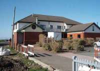
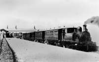
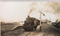
Knott End

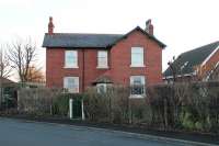
Small extract from a map dated c1910 showing the simple layout of the recently opened Knott End station. In addition to the station itself there is a Goods Shed and a Carriage Shed. The small building at right angles to the latter is Station House see image 57696. The fields to the east of the railway have since been completely built over and most of the railway land has been given over to car parking. Added by Mark Bartlett. Reproduced with the permission of the National Library of Scotland http://maps.nls.uk/index.html
Location: Knott End (former)
Original line: Knott End Railway
Photographer: National Library of Scotland
Contact photographer: National Library of Scotland
Date: 1910
Image number: 57719
Other photographs of Knott End on RailScot
 |  |  |  |  |  |  |  |  |  |
