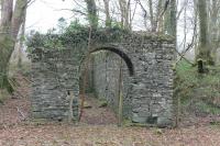
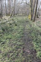
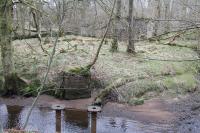
Kames Gunpowder Works

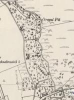
An extract from the 1895 6 inch OS map showing the Lower Mills (or south) site of the Kames Gunpowder Works. The complex layout of the horse drawn tramway, linking the widely dispersed buildings on the site, can be clearly seen. Used today the map makes it possible to interpret the remains of this heavily overgrown site which ceased operations in 1921. The clear circular area now forms the local cemetery. Added by Mark Bartlett. Reproduced with the permission of the National Library of Scotland http://maps.nls.uk/index.html
Location: Kames Gunpowder Works (former)
Original line: Kames Powder Works Company
Photographer: National Library of Scotland
Contact photographer: National Library of Scotland
Date: 06/04/2018
Image number: 63715
Other photographs of Kames Gunpowder Works on RailScot
 |  |  |  |  |  |  |  |  |  |
