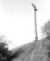
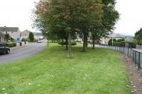
Newtongrange [Village]

View north east across the B6482, Suttieslea Road, Newtongrange, on 22 September 2019. The surviving bridge parapets stand above the filled in cutting once used by the Easthouses Tramway. The parallel mineral line used a level crossing less than 100 yards west of here (of which no trace remains). Behind the modern housing estate in the background is the site of Bryans Pit.
Location: Newtongrange [Village]
Original line: Lothian Coal Company
Photographer: John Furnevel
Contact photographer: John Furnevel
Date: 22/09/2019
Image number: 72056
Other photographs of Newtongrange [Village] on RailScot
 |  |  |  |  |  |  |
