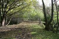
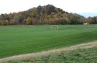
Arniston Colliery Emily Pit

Part of an OS Series map published in 1955 showing the Emily and Gore pits, the last survivors of the former 'Arniston Engine' complex, located to the north of Gorebridge.
On the left is the Waverley Route shown crossing the A7, while on the right is the B704 Hunterfield Road. Running between the two across the top of the map is Engine Road.
Note the access road linking Engine Road and the Gore Pit passing between the two colliery waste 'bings'. Note also the cable tramway running from the Emily Pit, through a tunnel in the north (original) bing and over a bridge across the access road to reach a tipping point on the south bing. (See Railscot article)
Location: Arniston Colliery Emily Pit (former)
Original line: Arniston Coal Company
Photographer: John Furnevel
Contact photographer: John Furnevel
Date: 07/11/2017
Image number: 61725
Other photographs of Arniston Colliery Emily Pit on RailScot
 |  |  |  |  |  |  |  |  |  |
