Dalbeattie charity fundraiser believes old Dumfries and Galloway railway line could become popular walking route [Daily Record]
Date: 24/02/2023
Alan Mclellan walked the old Port Road from Dumfries to Portpatrick and reckons a bit of tidying up would allow others to follow suit
External links
Daily Record
Related images
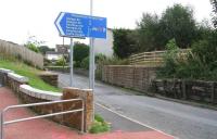
Shortly after leaving Dumfries northbound, trains on the Port Road to Stranraer turned west and crossed a bridge over Nunholme Road. The remains of that bridge mark the start of what is now the Maxwelltown Railway Path. This particular part of Dumfries stands within a loop formed by the River Nith, with Nunholme Road continuing north to reach a car parking area on the south bank; while 150 yards to the west the path crosses the river on the former Nith Viaduct, now renamed Queen of the South Viaduct see image [[25379]].
See query 2189
Location: Maxwelltown
Company: Castle Douglas and Dumfries Railway
01/09/2009 John Furnevel
See query 2189
Location: Maxwelltown
Company: Castle Douglas and Dumfries Railway
01/09/2009 John Furnevel
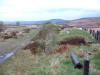
The site of the signalbox at Loch Skerrow viewed from the end of the remaining platform looking east. Note the felled water column.
Location: Loch Skerrow
Company: Portpatrick Railway
21/05/2003 Ewan Crawford
Location: Loch Skerrow
Company: Portpatrick Railway
21/05/2003 Ewan Crawford
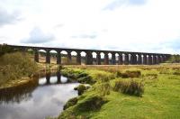
The impressive twenty arch Big Water of Fleet Viaduct looking south in May 2012.
Location: Big Water of Fleet Viaduct
Company: Portpatrick Railway
/05/2012 John Gray
Location: Big Water of Fleet Viaduct
Company: Portpatrick Railway
/05/2012 John Gray
Related news items
Tags: x Port Road x Dumfries x Castle Douglas x Newton Stewart x Stranraer x Portpatrick


