Charlestown Incline

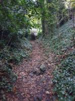
George Boyd's House. This is the end of what is now known as Shell Road, a footpath which follows the 1810 route of the Charlestown Railway over the Charlestown Viaduct and down to the harbour. The network of lines in this area and their sequencing was complex to say the least. The route of the 1799 branch into the village went left here and ran on the left hand side of what is now West Road. The path to the right leads across the bridge over the 1863 branch at the former Braeside Halt and on to Crombie Depot. Behind the camera is the road to Merryhill which also follows the route of the 1799 branch to Charlestown which diverged from the original waggonway to Limekilns at Meadowend. Whereas that line took an almost right angled bend left here towards the village, the later route to the 1834 station beside Camsie House also started from around this point and ran at around a 45 degree angle across what is now the cricket pitch to reach the station although that line was initially opened as a freight line with another incline to the harbour by around 1820. George Boyd's House stood on the right behind the camera and a relatively modern house stands roughly on the site of that much older house.
Location: Charlestown Incline (former)
Original line: Charlestown Railway
Photographer: Mark Poustie
Contact photographer: Mark Poustie
Date: 28/09/2020
Image number: 86981
Other photographs of Charlestown Incline on RailScot
 |
