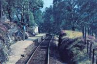
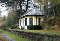
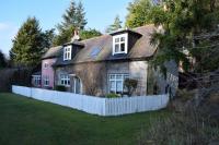
Cambus o' May

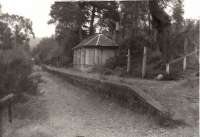
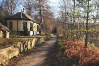
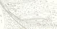
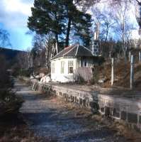
Part of the official plan shows the proposed position of the planned Aboyne and Braemar Railway as two red lines. At that time the name Cambus o'May only applied to the farm and Inn-there was no village. The red lines were drawn over farm outbuildings (numbered 44) and 'cut off' a corner of the main block. There seems to have been a mill building to the north east of the railway. Thus whilst most of the buildings were demolished the inn/farmhouse itself was saved from demolition by removing a small part of it. The building is now referred to as the 'dockit hoose' or 'Cutaway Cottage'. An historically important building was saved even if its farmyard 'offices' were demolished. In 1866 the inn would also have been provided with a slated roof, as, according to a contemporary Ordnance Survey description, it had previously had a thatched, probably heather, roof. It stopped being an Inn the following year after the death of James Ogg the last tenant Farmer and Innkeeper. The railway company seemed to have leased and later bought it as a house for its track workers (Waymen) and the early Cambus o'May Station Agents.
BR/ABR/3/1 Copyright Department for Transport. Original held by National Records of Scotland. With kind permission. Used under OGL 3.0 http://www.nationalarchives.gov.uk/doc/open-government-licence/version/3/
Location: Cambus o' May (former)
Original line: Aboyne and Braemar Railway
Photographer: Charlie Niven
Contact photographer: Charlie Niven
Date: 25/10/2019
Image number: 71624
Other photographs of Cambus o^ May on RailScot
 |  |  |  |  |  |  |  |  |  |
