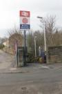
Burnley Barracks

Extract from the 1909 6-inch OS Map showing Burnley Barracks station and the line to Gannow Junction, where the Copy Pit line diverged south. Prominent on the map is the infantry barracks that operated from 1820 to 1898, the site of which has now almost completely disappeared. Most of the streets to the north of the station have since given way to the M65 Motorway and the main road to Padiham now runs to the south of the line through the site of the barracks leaving the Barracks Road and Cavalry Steet railway bridges in place but redundant. The dotted line marks the route of the Leeds Liverpool Canal through Gannow Tunnel before it turns to pass under the railway at Barracks station. Added by Mark Bartlett. Reproduced with the permission of the National Library of Scotland http://maps.nls.uk/index.html
Location: Burnley Barracks
Original line: Accrington, Burnley and Colne Branch (East Lancashire Railway)
Photographer: National Library of Scotland
Contact photographer: National Library of Scotland
Date: 1909
Image number: 71354
Other photographs of Burnley Barracks on RailScot
 |  |  |  |  |  |  |  |  |
