Maxwelltown

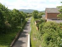
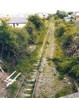
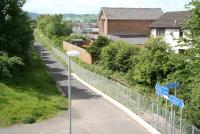
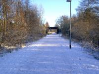
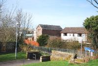
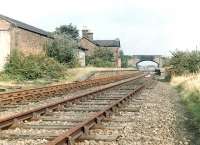
Shortly after leaving Dumfries northbound, trains on the Port Road to Stranraer turned west and crossed a bridge over Nunholme Road. The remains of that bridge mark the start of what is now the Maxwelltown Railway Path. This particular part of Dumfries stands within a loop formed by the River Nith, with Nunholme Road continuing north to reach a car parking area on the south bank; while 150 yards to the west the path crosses the river on the former Nith Viaduct, now renamed Queen of the South Viaduct see image 25379.
See query 2189
Location: Maxwelltown (former)
Original line: Castle Douglas and Dumfries Railway
Photographer: John Furnevel
Contact photographer: John Furnevel
Date: 01/09/2009
Image number: 71016
Other photographs of Maxwelltown on RailScot
 |  |  |  |  |  |  |  |  |  |
