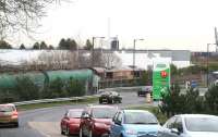
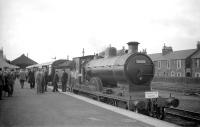
Grangemouth

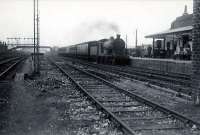
The Stirlingshire and West Lothian border area as seen on this 1957 OS One Inch Map. The name Manuel comes from Emmanuel: there was a
religious house here in medieval times. Sadly there is no known
connection with Spanish waiters. The nearby village of Whitecross is really a 20th century creation, so came too late to lend its name to the station. The formerly split-level the station now served only the main line, though the ticket office remained on the trackless lower level until closure in 1967. Note the 'Birch-hill' seems to have become Birkhill by the time the SRPS moved in! Now isn't Grangemouth station crying out for a re-opening? The Glasgow to Grahamston trains lie over on the branch. Crown copyright 1957.
Location: Grangemouth
Original line: Maps
Photographer: David Panton
Contact photographer: David Panton
Date: 1957
Image number: 33463
Tags: MapOther photographs of Grangemouth on RailScot
 |  |  |  |  |  |  |  |  |  |
